Probability of a tornado within 25 miles of a point. Hatched Area: 10% or greater probability of EF2 - EF5 tornadoes within 25 miles of a point.
Day 1 Tornado Risk
Area (sq. mi.)
Area Pop.
Some Larger Population Centers in Risk Area
No Risk Areas Forecast
Probabilistic Damaging Wind Graphic
Probability of damaging thunderstorm winds or wind gusts of 50 knots or higher within 25 miles of a point. Hatched Area: 10% of greater probability of wind gusts 65 knots or greater within 25 miles of a point.
SPC AC 131953
Day 1 Convective Outlook
NWS Storm Prediction Center Norman OK
0253 PM CDT Thu May 13 2021
Valid 132000Z - 141200Z
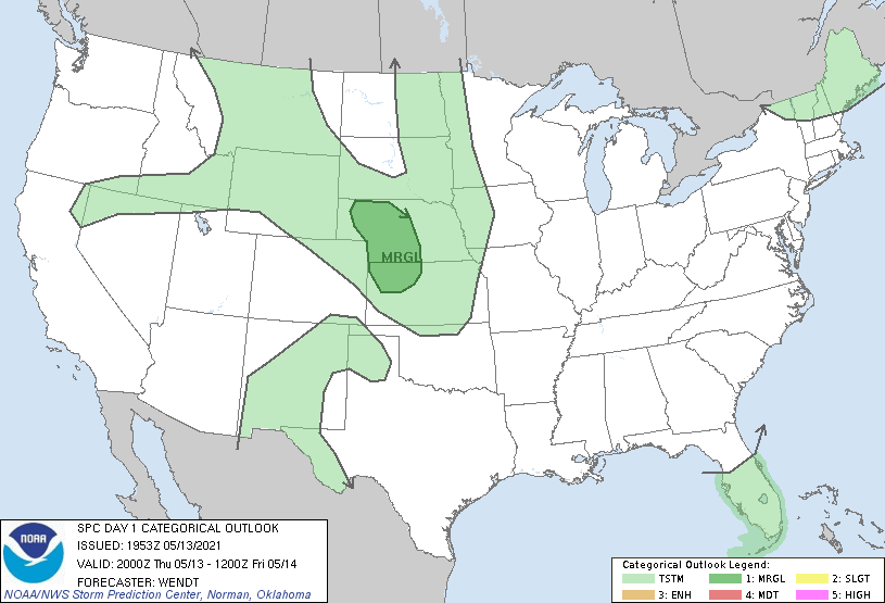
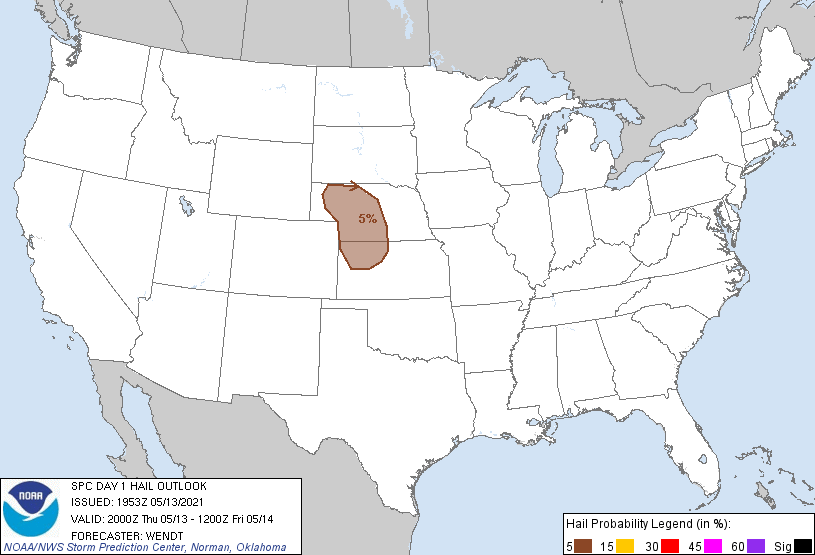
...THERE IS A MARGINAL RISK OF SEVERE THUNDERSTORMS PARTS OF
WESTERN/CENTRAL NEBRASKA AND NORTHWEST KANSAS...
...SUMMARY...
Isolated large hail and damaging gusts will be possible this
afternoon through late evening from western Nebraska into
northwestern Kansas.
...Synopsis...
No changes to the ongoing forecast. Thunderstorms have begun to form
in western Nebraska are expected to move southeastward this
afternoon and evening. See MCD 605 for more details.
..Wendt.. 05/13/2021
.PREV DISCUSSION... /ISSUED 1122 AM CDT Thu May 13 2021/
...Central High Plains this afternoon through late evening...
A low-amplitude western ridge/eastern trough pattern will persist
across the CONUS, with a belt of west-northwesterly mid-upper flow
from the northern Rockies across the central Plains to the
Southeast. Within this belt of stronger flow, an embedded shortwave
trough over southern MT/northwestern WY will progress
east-southeastward to NE by this evening/early tonight. Weak lee
cyclogenesis is anticipated near the NE/WY border this
afternoon/evening in advance of this midlevel trough, which will
help to strengthen low-level southerly flow across NE/KS late this
afternoon into early tonight. Low-level moisture is quite limited
across the Great Plains this morning as a result of prior frontal
passages, with regional 12z soundings and surface observations
showing low-mid 40s boundary-layer dewpoints. Strong surface
heating and some vertical mixing of the marginal moisture suggests
that MLCAPE will likely be limited to around 500 J/kg.
High-based thunderstorm development is expected later this
afternoon/evening across western NE, along and immediately east of
the lee cyclone/lee trough. Convection will subsequently spread
south-southeastward across western/central NE toward northwestern KS
later this evening into early tonight. Deep-layer vertical shear
will favor supercells with some threat for marginally severe hail,
while steep low-level lapse rates will favor strong outflow
production as storms potentially grow upscale into a small cluster
or two. An increase in low-level warm advection will help the
convection persist into tonight, though the threat for severe storms
will diminish.
CLICK TO GET WUUS01 PTSDY1 PRODUCT
NOTE: THE NEXT DAY 1 OUTLOOK IS SCHEDULED BY 0100Z