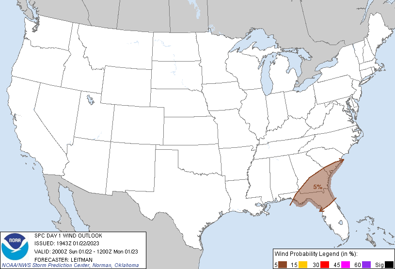
Probability of damaging thunderstorm winds or wind gusts of 50 knots or higher within 25 miles of a point. Hatched Area: 10% of greater probability of wind gusts 65 knots or greater within 25 miles of a point.
Probability of hail 1" or larger within 25 miles of a point. Hatched Area: 10% or greater probability of hail 2" or larger within 25 miles of a point.
Day 1 Hail Risk
Area (sq. mi.)
Area Pop.
Some Larger Population Centers in Risk Area
No Risk Areas Forecast
SPC AC 221943
Day 1 Convective Outlook
NWS Storm Prediction Center Norman OK
0143 PM CST Sun Jan 22 2023
Valid 222000Z - 231200Z
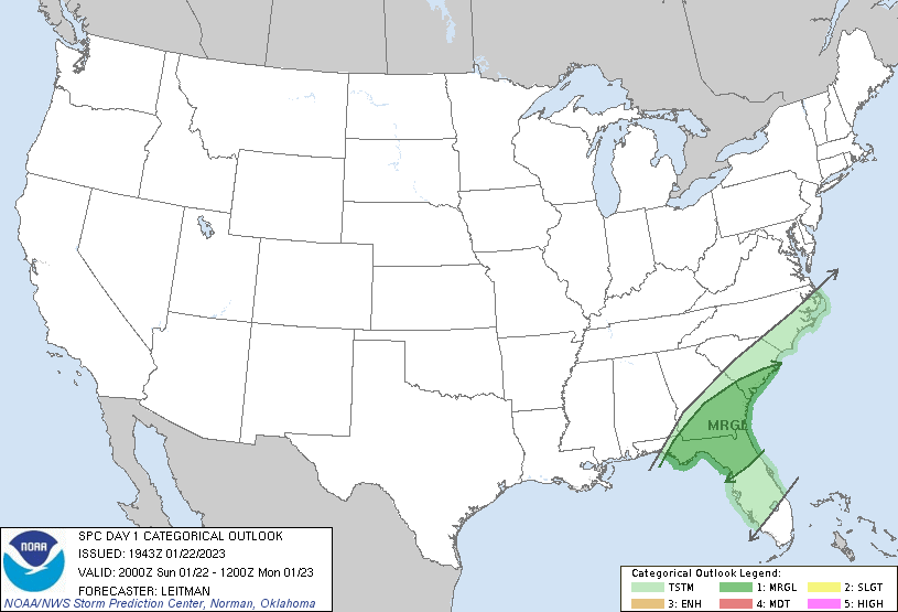
...THERE IS A MARGINAL RISK OF SEVERE THUNDERSTORMS ACROSS NORTHERN
FL...SOUTHERN GA AND SOUTHEAST SC...
...SUMMARY...
A few marginally severe thunderstorms are possible through this
evening over a corridor from northern Florida into southern Georgia
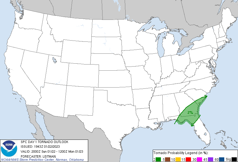
and southern South Carolina. An isolated tornado or damaging gust is
possible.
...20z Update...
Only minor adjustments have been made to the outlook with the 20z
update. Thunderstorm activity/intensity may increase over the next
few hours as convection moves toward northern FL/southeast GA.
Stronger heating has resulted in somewhat better destabilization and
steepening of low-level lapse rates across this area. Stronger
convection will continue to pose a threat for locally damaging
gusts, while moderate speed shear contributes to somewhat enlarged
low-level hodographs, supporting rotation and possibly a tornado.
The severe threat is expected to diminish this evening.
..Leitman.. 01/22/2023
.PREV DISCUSSION... /ISSUED 0959 AM CST Sun Jan 22 2023/
...Synopsis...
A 1010 mb surface low over the FL Panhandle with continue to drift
to the northeast as a mid-level longwave trough continues to
approach the Gulf Coast states from the west. Modest northeastward
advection of low-level moisture will promote marginal buoyancy
across the southeast into the Carolinas, that in tandem with
deep-layer ascent will support at least scattered thunderstorms
throughout the day. Isolated severe thunderstorms are possible.
...Northern Florida into southern South Carolina..
Heavier showers with isolated embedded thunderstorms are ongoing
within a confluence band across portions of the FL Panhandle into
southern GA and southern SC. This confluence band will drift slowly
eastward through the afternoon in tandem with the surface low. As
warm-air/moisture advection continues along and ahead of the
confluence band, and as a cold front approaches from the west, both
increasing buoyancy and deep-layer ascent may support a brief uptick
in convective intensity later today. From northern FL into southern
GA and far southern SC, surface temperatures rising into the upper
60s F (with at least mid 60s F surface dewpoints), overspread by
5.5-6 C/km mid-level lapse rates will result in 500-1000 J/kg of
thin MLCAPE. Though vertical wind profiles should be largely
unidirectional, strong speed shear will contribute to widespread 50+
kts of effective bulk shear, with regional VADs and point-forecast
soundings also indicating modest low-level hodograph curvature (and
200-300 m2/s2 effective SRH). As such, any storms that manage to
organize and intensify later this afternoon could acquire some
low-level rotation, with an isolated tornado or damaging gust
possible before the confluence band moves offshore.
CLICK TO GET WUUS01 PTSDY1 PRODUCT
NOTE: THE NEXT DAY 1 OUTLOOK IS SCHEDULED BY 0100Z