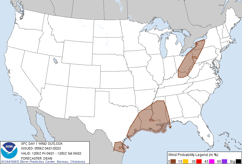
Probability of damaging thunderstorm winds or wind gusts of 50 knots or higher within 25 miles of a point. Hatched Area: 10% of greater probability of wind gusts 65 knots or greater within 25 miles of a point.
SPC AC 210556
Day 1 Convective Outlook
NWS Storm Prediction Center Norman OK
1256 AM CDT Fri Apr 21 2023
Valid 211200Z - 221200Z
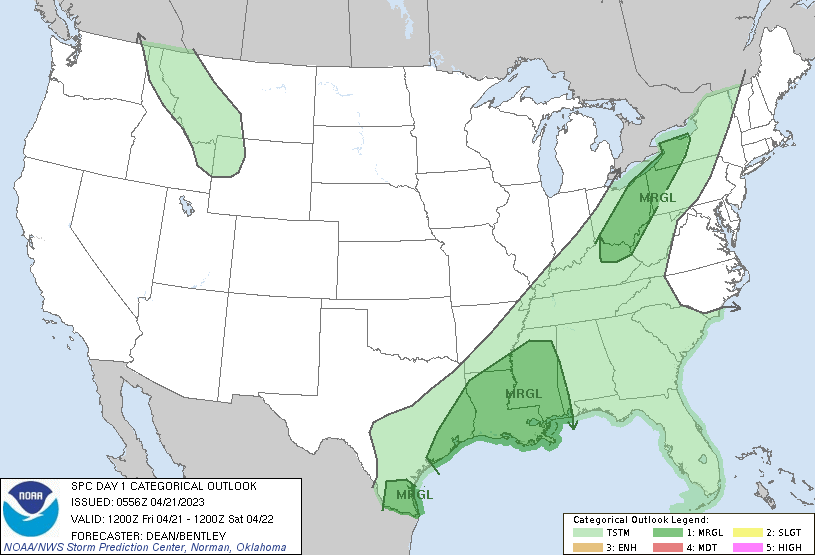
...THERE IS A MARGINAL RISK OF SEVERE THUNDERSTORMS FOR PARTS OF
SOUTH AND EAST TX INTO THE LOWER MS VALLEY...AND ALSO FROM THE UPPER
OH VALLEY INTO THE LOWER GREAT LAKES...
...SUMMARY...
Isolated severe thunderstorms will be possible today across parts of
the upper Texas coastal plain into the lower Mississippi Valley, and
also across deep south Texas. Large hail and locally damaging gusts
will be possible. A few strong storms capable of damaging gusts will
also be possible across the upper Ohio Valley into the lower Great
Lakes region.
...Synopsis...
A deep longwave trough will remain in place across the central CONUS
today. One embedded shortwave trough will move into Ontario from the
upper Great Lakes region during the day today, while another
embedded shortwave and attendant midlevel jet maximum move
east-southeastward from the southern Plains toward the lower MS
Valley. A deep-layer cyclone will move slowly eastward across the
upper Great Lakes region, while one or more surface waves may
develop along a cold front that will be draped from south TX into
the lower MS Valley, OH Valley, and lower Great Lakes.
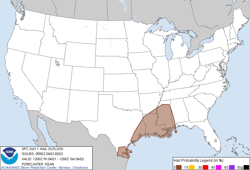
...Parts of south and east TX into the lower MS Valley...
Considerable uncertainty remains regarding the evolution of
convection across TX into the lower MS Valley overnight, prior to
the start of the forecast period at 12Z this morning. A weakening
MCS may be ongoing near the upper TX and LA Gulf Coasts into the
northwest Gulf of Mexico, with some potential for elevated
redevelopment in the wake of the MCS. Steep midlevel lapse rates,
moderate MUCAPE, and sufficient deep-layer shear will support some
threat for hail and isolated damaging gusts with any stronger
elevated convection during the morning. Wind profiles will remain
favorable for organized storms through the day, so depending on the
extent of destabilization this afternoon, isolated severe storms may
redevelop from LA into MS along the front.
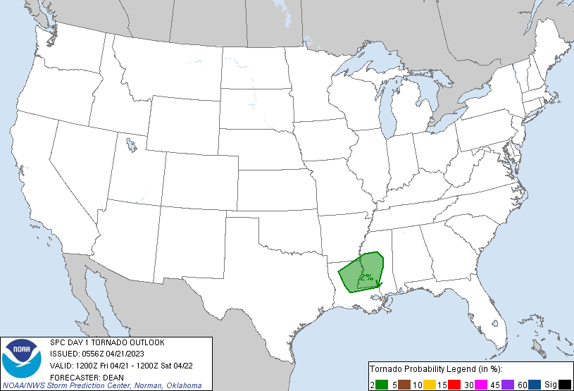
The environment farther southwest into deep south TX is likely to be
relatively undisturbed by earlier convection, and moderate to strong
buoyancy is likely to be in place during the afternoon. With
generally weak surface convergence and limited large-scale ascent,
storm coverage is expected to remain isolated at best, but
sufficient deep-layer shear (with northwesterly flow aloft) will
support a conditional risk for a supercell or two with large-hail
potential.
...Upper OH Valley into the lower Great Lakes region...
Low-level moisture will remain limited from the OH Valley into the
Great Lakes region, but relatively strong diurnal heating will
support MLCAPE increasing into the 250-500 J/kg range this
afternoon, with scattered thunderstorm development expected. Steep
low-level lapse rates and modestly enhanced low-level flow will
support the potential for isolated strong/damaging gusts before the
threat diminishes with the onset of nocturnal cooling this evening.
..Dean/Bentley.. 04/21/2023
CLICK TO GET WUUS01 PTSDY1 PRODUCT
NOTE: THE NEXT DAY 1 OUTLOOK IS SCHEDULED BY 1300Z