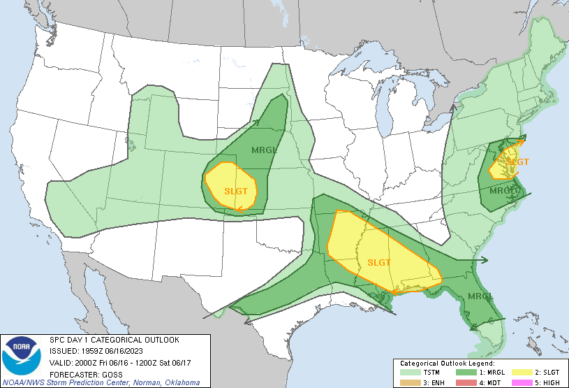
Probability of a tornado within 25 miles of a point. Hatched Area: 10% or greater probability of EF2 - EF5 tornadoes within 25 miles of a point.
Day 1 Tornado Risk
Area (sq. mi.)
Area Pop.
Some Larger Population Centers in Risk Area
2 %
42,820
839,053
Colorado Springs, CO...Parker, CO...Castle Rock, CO...Garden City, KS...Cimarron Hills, CO...
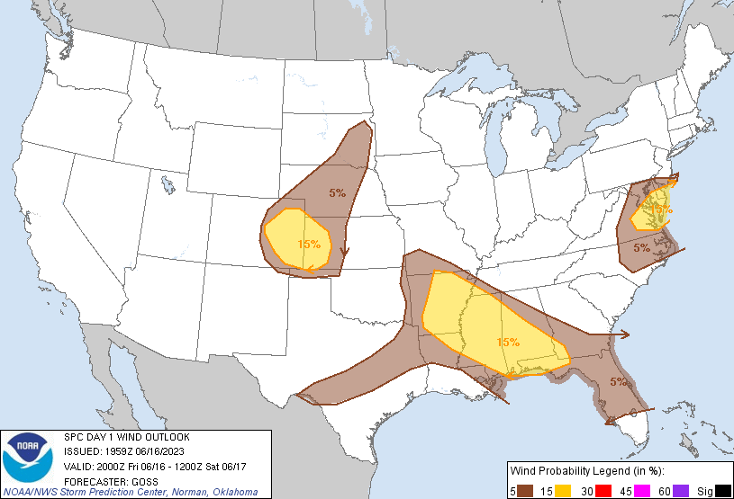
Probabilistic Damaging Wind Graphic
Probability of damaging thunderstorm winds or wind gusts of 50 knots or higher within 25 miles of a point. Hatched Area: 10% of greater probability of wind gusts 65 knots or greater within 25 miles of a point.
Day 1 Wind Risk
Area (sq. mi.)
Area Pop.
Some Larger Population Centers in Risk Area
15 %
194,944
13,553,083
Memphis, TN...Colorado Springs, CO...Norfolk, VA...Chesapeake, VA...Montgomery, AL...
SPC AC 161959
Day 1 Convective Outlook
NWS Storm Prediction Center Norman OK
0259 PM CDT Fri Jun 16 2023
Valid 162000Z - 171200Z
...THERE IS A SLIGHT RISK OF SEVERE THUNDERSTORMS ACROSS PORTIONS OF
THE MID-ATLANTIC REGION...CENTRAL HIGH PLAINS...AND FROM THE
ARKANSAS VICINITY SOUTHEASTWARD INTO THE FLORIDA PANHANDLE AND
SOUTHWESTERN GEORGIA...
...SUMMARY...
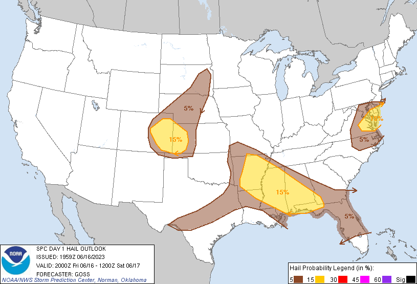
Large hail and damaging thunderstorms winds are possible across
parts of the central High Plains, Southeast U.S. and Mid-Atlantic.
...Discussion...
Little in the way of substantive changes are being implemented to
the outlook at this time, as reasoning and areas laid out in the
prior package remain consistent with current and expected trends.
The most substantial change has been to expand the SLGT risk area in
the lower Mississippi Valley region a bit farther northwestward,
toward the Ozarks, where storms are currently increasing in coverage
and may pose local hail/wind risk greater than previously
anticipated. For additional short-term information, please refer to
SWOMCD #1107.
..Goss.. 06/16/2023
.PREV DISCUSSION... /ISSUED 1130 AM CDT Fri Jun 16 2023/
...Mid Atlantic...
A prominent mid-level trough and associated 50 knot jet max is
rotating across the Mid-Atlantic region today. Scattered
thunderstorms have already formed along the surface cold front over
eastern PA and NJ. These storms will track eastward and offshore,
while new activity builds southward into eastern MD/VA. Cool
temperatures aloft, steep mid-level lapse rates, and favorable
deep-layer vertical shear will provide support for strong-severe
storms capable of damaging winds and hail through the late
afternoon.
...CO/KS...
Morning model guidance hints at a weak shortwave trough over
northern NM approaching the High Plains. Ahead of the trough,
strong daytime heating/destabilization is occurring along and south
of a surface boundary paralleling the Palmer Ridge. Scattered
thunderstorms are expected to develop in the instability axis by
mid-afternoon, tracking eastward into western KS this evening.
Early storms will be discrete, with a few supercells producing large
hail. As the storms build eastward, upscale growth into bowing
structures is expected, with an increasing risk of locally damaging
wind gusts.
...AR to AL...
Scattered showers and thunderstorms have developed this morning over
northwest AR - ahead of a mid-level shortwave trough over northeast
OK. The air mass ahead of these storms over AR/MS is very moist and
unstable, with afternoon MLCAPE values expected to reach 3000 J/kg.
Storms are expected to intensify to severe levels by mid-afternoon
and track southeastward. Morning CAM solutions vary in the
timing/placement of the corridor of greatest risk, ranging from
northern MS/AL into northern LA. Regardless, clusters of storms are
expected this evening tracking into parts of AL before weakening.
Damaging winds and hail will be possible in the strongest cells.
...FL Panhandle...
A long-lived MCS is finally decaying as it tracks across the central
FL panhandle. This activity is likely to dissipate by mid
afternoon, with only a marginal risk of new storms forming on the
remnant outflow boundaries.
CLICK TO GET WUUS01 PTSDY1 PRODUCT
NOTE: THE NEXT DAY 1 OUTLOOK IS SCHEDULED BY 0100Z