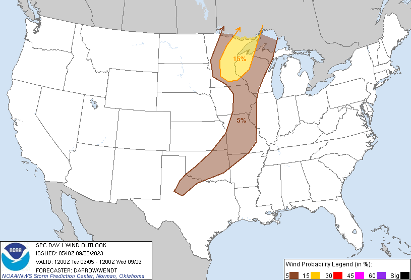
Probability of damaging thunderstorm winds or wind gusts of 50 knots or higher within 25 miles of a point. Hatched Area: 10% of greater probability of wind gusts 65 knots or greater within 25 miles of a point.
Oklahoma City, OK...Tulsa, OK...Springfield, MO...Cedar Rapids, IA...Independence, MO...
SPC AC 050548
Day 1 Convective Outlook
NWS Storm Prediction Center Norman OK
1248 AM CDT Tue Sep 05 2023
Valid 051200Z - 061200Z
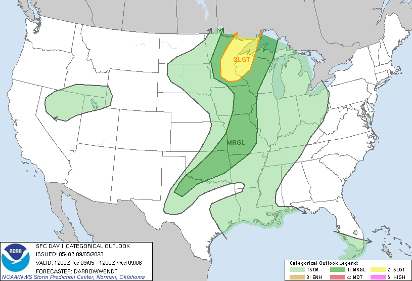
...THERE IS A SLIGHT RISK OF SEVERE THUNDERSTORMS ACROSS THE UPPER
MISSISSIPPI VALLEY...
...SUMMARY...
Isolated severe storms -- accompanied primarily by hail/wind
potential -- will be possible on Tuesday across parts of the Upper
Mississippi Valley. Gusty winds are also possible with isolated
storms across the mid Mississippi Valley into portions of the
southern Plains.
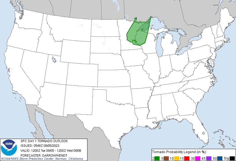
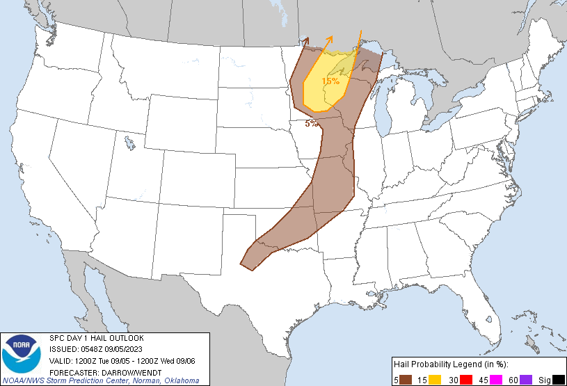
...Upper Mississippi Valley...
Strong short-wave trough is progressing east across the northern
High Plains early this morning. Latest water-vapor imagery depicts a
well-defined mid-level vort near the Black Hills. This feature is
forecast to eject across SD early in the period before approaching
the SD/MN border around 05/00z. Associated surface front should sag
southeast across northwestern MN by mid day as a weak surface low
advances east across the upper MS Valley.
Latest radar data depicts a notable MCS has evolved over eastern ND
with a progressive-propagating squall line now spreading toward
northwest MN. This activity should spread into southeast
MB/northwest ON early in the period. By late morning, model guidance
suggests boundary-layer heating will aid destabilization immediately
ahead of the wind shift across northern/central MN. Renewed
convection should initiate along the wind shift by 18z then
spread/develop east toward the Arrowhead/northwestern WI. Forecast
soundings exhibit substantial flow/shear for supercells and initial
convection may be supercellular in nature. Thermodynamic profiles
favor hail and wind with this activity. Strong deep-layer flow and
adequate low-level shear suggest some tornado potential, but this
should be secondary to the hail/wind threat.
...Mid MS Valley/Southern Plains...
As the northern Plains short-wave trough advances toward the MS
Valley, stronger mid-level flow will spread across KS toward MO.
Some increase will likely be noted at lower latitudes into northern
OK/AR. There is increasing concern that isolated severe storms will
evolve along the southern influence of the short wave where intense
surface heating is expected ahead of the front. Latest model
guidance suggests a deep boundary layer along a corridor from
northwest TX, across central OK into southeast KS by late afternoon.
Forecast soundings suggest convective temperatures will be breached
between 22Z and 00Z as temperatures soar to near/just above 100F.
With seasonally high PW values, it appears gusty downbursts may be
noted with this activity. At this time will introduce a MRGL to
account for this threat, but some large-scale support appears
possible across southeast KS into MO as the ridge is suppressed.
This activity could be a bit more organized than convection farther
southwest along the wind shift across central OK into northwest TX.
..Darrow/Wendt.. 09/05/2023
CLICK TO GET WUUS01 PTSDY1 PRODUCT
NOTE: THE NEXT DAY 1 OUTLOOK IS SCHEDULED BY 1300Z