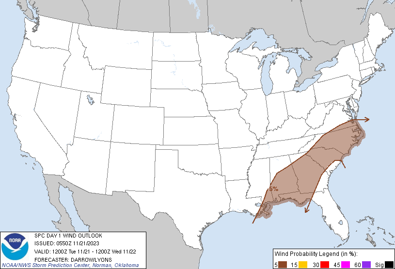
Charlotte, NC...Virginia Beach, VA...Atlanta, GA...Raleigh, NC...Norfolk, VA...
Probabilistic Damaging Wind Graphic
Probability of damaging thunderstorm winds or wind gusts of 50 knots or higher within 25 miles of a point. Hatched Area: 10% of greater probability of wind gusts 65 knots or greater within 25 miles of a point.
Day 1 Wind Risk
Area (sq. mi.)
Area Pop.
Some Larger Population Centers in Risk Area
5 %
182,791
27,011,295
Charlotte, NC...Virginia Beach, VA...Atlanta, GA...Raleigh, NC...Norfolk, VA...
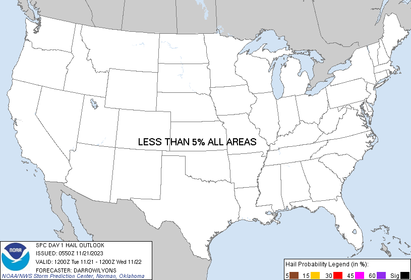
Probabilistic Large Hail Graphic
Probability of hail 1" or larger within 25 miles of a point. Hatched Area: 10% or greater probability of hail 2" or larger within 25 miles of a point.
Day 1 Hail Risk
Area (sq. mi.)
Area Pop.
Some Larger Population Centers in Risk Area
No Risk Areas Forecast
SPC AC 210550
Day 1 Convective Outlook
NWS Storm Prediction Center Norman OK
1150 PM CST Mon Nov 20 2023
Valid 211200Z - 221200Z
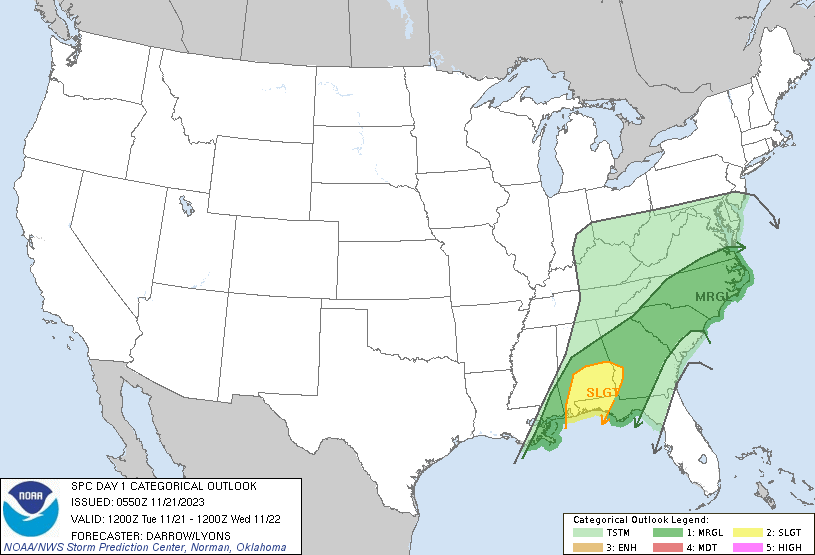
...THERE IS A SLIGHT RISK OF SEVERE THUNDERSTORMS ACROSS PORTIONS OF
SOUTHERN ALABAMA AND THE WESTERN FLORIDA PANHANDLE AND SOUTHWEST
GEORGIA...
...SUMMARY...
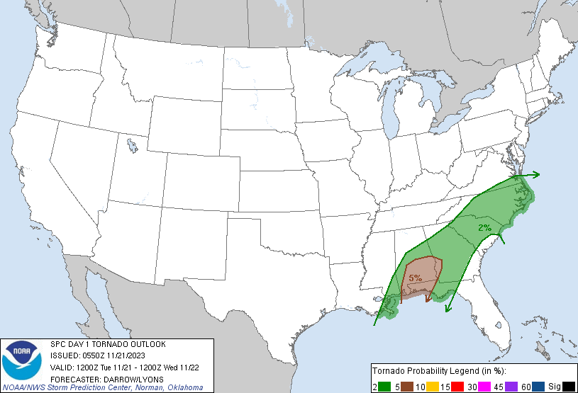
A few tornadoes are possible across south Alabama and the Florida
Panhandle, mainly during the morning into the afternoon. The
potential for locally damaging winds and a couple brief tornadoes
will shift farther north and east this afternoon into early morning
Wednesday across most of Georgia, the Carolinas, and far southern
Virginia.
...Southeastern US...
Latest satellite imagery suggests center of upper low is located
near JLN. This feature is forecast to eventually dig southeast
toward the mid-South as a secondary 500mb speed max translates
southeast across eastern OK into southern AR by the end of the
period. Immediately downstream, a corridor of strong midlevel flow
will extend across the lower MS Valley into the middle Atlantic.
00z model guidance suggests modest height falls will develop ahead
of this trough with values approaching 90m in 12hr, especially
across the northern middle Atlantic region. In response to this
trough, a weak surface low will advance across the OH Valley into
southeast lower MI by late afternoon; however, a secondary surface
low should evolve along the southern fringe of the Appalachians then
track northeast into the Delmarva by 22/12z. This secondary surface
low will prove instrumental in allowing modified air mass to advance
across the Carolinas during the latter half of the period, with even
weak buoyancy likely developing farther north during the overnight
hours.
Late this evening, an extensive corridor of deep convection has
evolved within a strongly diffluent high-level flow regime from
western AL-southern MS-southeast LA-western Gulf Basin. This
corridor should progress steadily east through sunrise and likely
extend across much of AL into the MS delta region by the start of
the period. Strong deep-layer flow/shear will support organized
convection, and embedded supercells are likely along this band.
Forecast soundings at the start of the period exhibit MLCAPE in
excess of 500 J/kg within a very moist and poor-lapse
rate-environment. NAM soundings for PNS and GZH at 12z display 0-3km
SRH between 400-700 m2/s2. Large-scale forcing should encourage an
organized band of convection to migrate east, but this activity
should weaken a bit downstream as it encounters less buoyancy and
weaker forcing over northern FL/southeast GA.
During the latter half of the period, primarily after 06z,
boundary-layer recovery is expected across coastal Carolinas such
that buoyancy will become more supportive of deep updrafts. Strong
shear will favor organized convection, along with some supercell
potential. Forecast soundings are quite moist with poor lapse rates
through 9km. This will limit instability but isolated damaging winds
and/or a tornado seem possible with this activity.
..Darrow/Lyons.. 11/21/2023
CLICK TO GET WUUS01 PTSDY1 PRODUCT
NOTE: THE NEXT DAY 1 OUTLOOK IS SCHEDULED BY 1300Z