Probability of damaging thunderstorm winds or wind gusts of 50 knots or higher within 25 miles of a point. Hatched Area: 10% of greater probability of wind gusts 65 knots or greater within 25 miles of a point.
SPC AC 230559
Day 2 Convective Outlook
NWS Storm Prediction Center Norman OK
1259 AM CDT Tue May 23 2023
Valid 241200Z - 251200Z
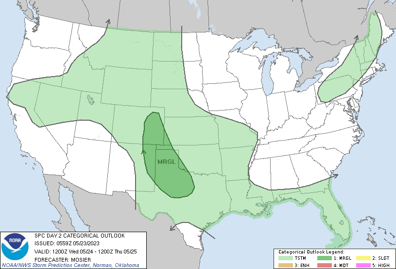
...THERE IS A MARGINAL RISK OF SEVERE THUNDERSTORMS FROM CENTRAL AND
SOUTHERN HIGH PLAINS INTO NORTHWEST TEXAS...
...SUMMARY...
Isolated strong to severe thunderstorms are possible from the
central and southern High Plains into northwest Texas.
...Synopsis...
Upper ridging is forecast to persist across the central CONUS on
Wednesday, while the flanking upper troughs both deepen slightly.
Deepening of the western CONUS upper troughing is expected later in
the period as shortwave trough rotates through its base over
central/southern CA. Primary feature within the eastern CONUS
troughing will be a shortwave trough expected to move through
eastern Ontario and southern Quebec and into the Northeast while
maturing.
At the surface, lee troughing is expected to sharpen somewhat on
Wednesday, contributing to stronger southeasterly surface winds.
These stronger winds will result in better low-level convergence,
particularly over the central and northern High Plains, with
afternoon thunderstorms anticipated across the majority of the High
Plains. Farther north and east, a strong cold front is expected to
push southward/southeastward across the OH Valley and Northeast.
Modest buoyancy may develop ahead of this front, supporting
thunderstorm potential.
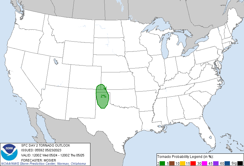
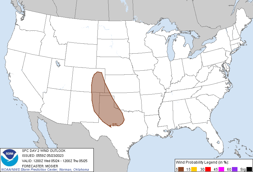
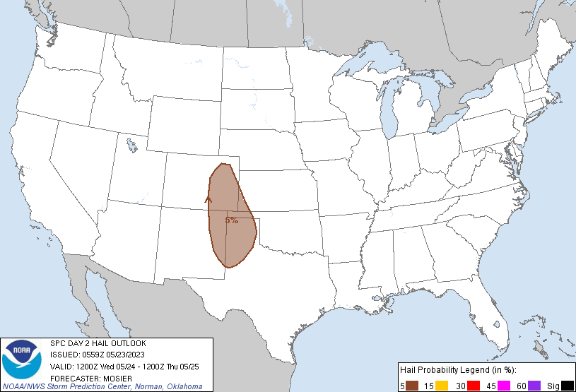
....Central and Southern High Plains...
Thunderstorms are once again forecast to develop during the
afternoon over both the higher terrain and along the lee trough.
Northwesterly flow will then take these storms into a more buoyant
air mass downstream, with consolidation along outflows into a more
coherent line possible. Some potential exist for a few discrete
cells, particularly along the lee trough, resulting in a non-zero
threat for isolated hail and/or a brief tornado or two.
...Central TX...
Remnant MCV generated by preceding convection may be in place over
the region early Wednesday morning. Some enhancement of both the
mid-level flow and low-level convergence is possible in the vicinity
of this vorticity max, contributing to some potential for a few
stronger, more organized storms. However, uncertainty regarding the
location and strength of this MCV limits forecast confidence,
precluding the addition of any associated severe probabilities with
this outlook.
...Great Basin into the northern Rockies...
Afternoon thunderstorms are possible ahead of subtle shortwave
trough rounding the based of the larger upper troughing over the
western CONUS. Low-level moisture will be meager, but modest
buoyancy is still anticipated via cold temperatures aloft. Given the
deep southerly flow aloft anticipated, a strong gust or two is
possible with any more robust and persistent updrafts, although
overall coverage will likely be limited.
...Northeast...
A narrow corridor of modest buoyancy may develop over the region
ahead of an approaching shortwave and attendant cold front. Forcing
for ascent along the front will be augmented by large-scale ascent
attendant to the shortwave, supporting showers and thunderstorms as
it interacts with this buoyancy. However, overall buoyancy will be
mitigate by poor mid-level lapse rates, and updrafts will likely be
shallow and short lived. As such, the severe potential is expected
to be low.
..Mosier.. 05/23/2023
CLICK TO GET WUUS02 PTSDY2 PRODUCT
NOTE: THE NEXT DAY 2 OUTLOOK IS SCHEDULED BY 1730Z