Oklahoma City, OK...Tulsa, OK...Wichita, KS...Broken Arrow, OK...Edmond, OK...
MARGINAL
318,787
72,307,642
New York, NY...Philadelphia, PA...Detroit, MI...Baltimore, MD...Washington, DC...
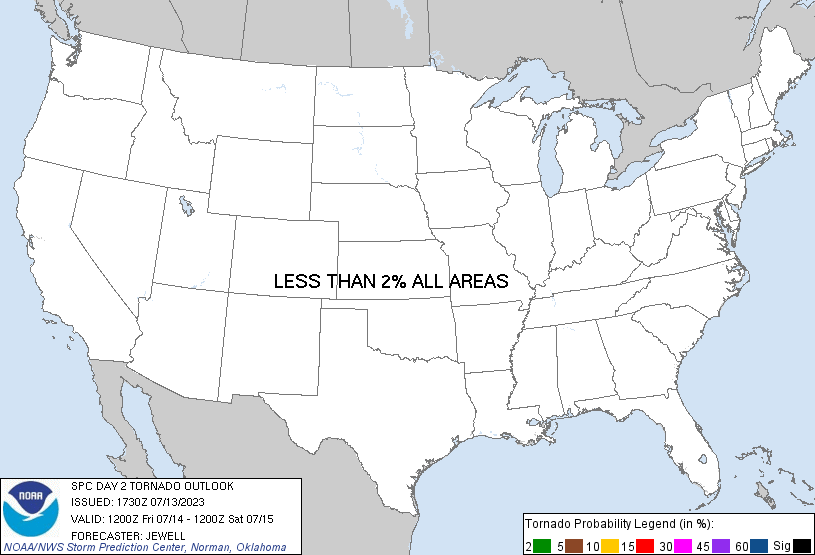
Probabilistic Tornado Graphic
Probability of a tornado within 25 miles of a point. Hatched Area: 10% or greater probability of EF2 - EF5 tornadoes within 25 miles of a point.
Day 2 Tornado Risk
Area (sq. mi.)
Area Pop.
Some Larger Population Centers in Risk Area
No Risk Areas Forecast
Probabilistic Damaging Wind Graphic
Probability of damaging thunderstorm winds or wind gusts of 50 knots or higher within 25 miles of a point. Hatched Area: 10% of greater probability of wind gusts 65 knots or greater within 25 miles of a point.
Day 2 Wind Risk
Area (sq. mi.)
Area Pop.
Some Larger Population Centers in Risk Area
15 %
110,156
5,079,298
Oklahoma City, OK...Tulsa, OK...Wichita, KS...Broken Arrow, OK...Edmond, OK...
5 %
321,847
73,362,058
New York, NY...Philadelphia, PA...Detroit, MI...Baltimore, MD...Washington, DC...
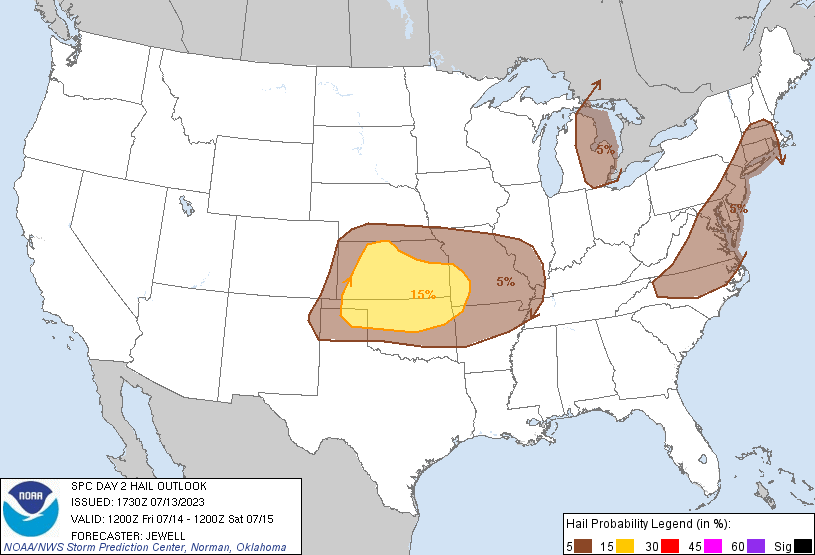
Probabilistic Large Hail Graphic
Probability of hail 1" or larger within 25 miles of a point. Hatched Area: 10% or greater probability of hail 2" or larger within 25 miles of a point.
Day 2 Hail Risk
Area (sq. mi.)
Area Pop.
Some Larger Population Centers in Risk Area
15 %
108,884
5,029,125
Oklahoma City, OK...Tulsa, OK...Wichita, KS...Broken Arrow, OK...Edmond, OK...
5 %
324,786
74,468,662
New York, NY...Philadelphia, PA...Detroit, MI...Baltimore, MD...Boston, MA...
SPC AC 131730
Day 2 Convective Outlook
NWS Storm Prediction Center Norman OK
1230 PM CDT Thu Jul 13 2023
Valid 141200Z - 151200Z
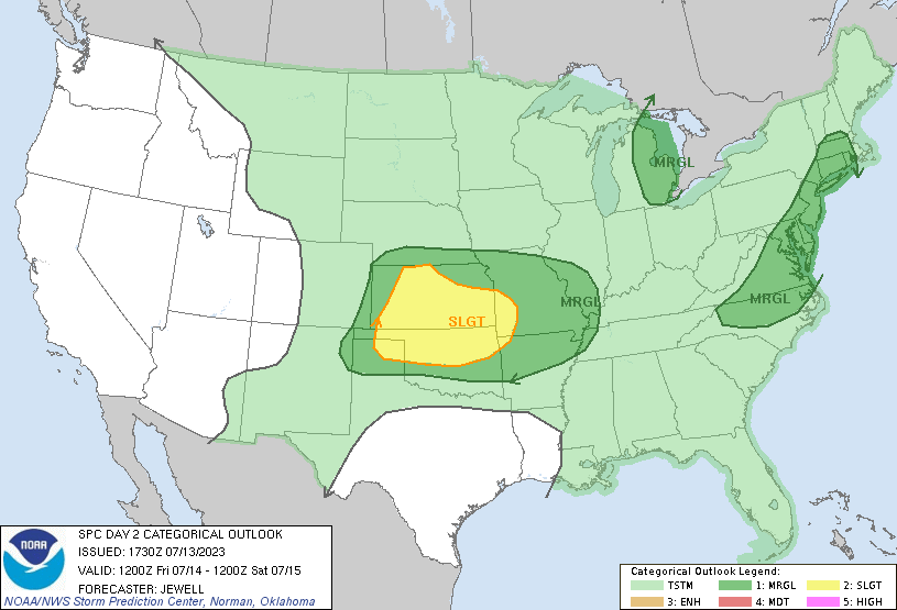
...THERE IS A SLIGHT RISK OF SEVERE THUNDERSTORMS OVER MUCH OF
KANSAS...OKLAHOMA...AND SOUTHWEST MISSOURI...
...SUMMARY...
Thunderstorms producing damaging wind and sporadic hail are forecast
over much of the central Plains on Friday. Isolated damaging gusts
or marginal hail will also be possible over parts of the Mid
Atlantic and southern New England, and into parts of the southern
High Plains.
...Synopsis...
A large upper low will remain over Canada, with an upper ridge over
the Southwest. In between, moderate northwest flow aloft will
persist over the Plains. To the east, various weaker embedded waves
will affect parts of the OH Valley, Mid Atlantic, and Great Lakes.
Moisture will remain plentiful east of the Rockies, with the only
exception the northern Plains and upper MS Valley where drier air
will spread in from the northwest.
...Much of the central Plains...
Storms are forecast to be ongoing over NE Friday morning near a
stationary front and where low-level theta-e will be substantial.
Some of these storms could have hail relatively early in the day,
with an increasing threat throughout the day as the storms and the
boundary push south into KS where heating will occur. Large hail is
most likely with the initial activity, with a strong model signal of
an MCS eventually pushing south/southeast into OK and southwest MO
late. Damaging winds, as well as heavy rain, will become the primary
concern.
..NC into southern New England...
A deep-layer moist plume will remain in place with 850 mb winds out
of the south/southwest, and a weak surface trough from the Carolinas
into southern New England. Little heating will be needed to uncap
the air mass, with storms focused over NC and VA during the day
where lapse rates will be steepest. Another area of focus will be
over southern New England where southerly winds will bring 70s F
dewpoints northward across MA. Shear will not be very strong but
veering winds with height may favor a few cells producing marginal
hail.
...Upper Great Lakes/MI area...
Moistening will occur over Lower MI during the day as with a
west/southwest low-level wind regime, beneath cool midlevel
temperatures and 500 mb winds over 40 kt. Strong heating will occur,
which when combined with the rising dewpoints out of the southwest
will yield plentiful instability. Scattered storms are expected to
form over interior Lower MI during the late afternoon by virtue of
weak convergence and an uncapped air mass, and lengthy straight
hodographs will favor cellular storm mode with hail possible.
..Jewell.. 07/13/2023
CLICK TO GET WUUS02 PTSDY2 PRODUCT
NOTE: THE NEXT DAY 2 OUTLOOK IS SCHEDULED BY 0600Z