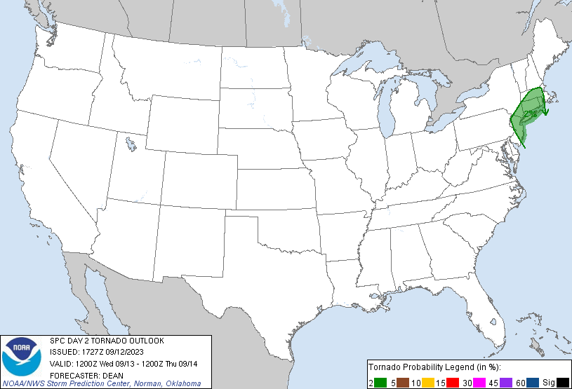
New York, NY...Newark, NJ...Jersey City, NJ...Yonkers, NY...Providence, RI...
Probabilistic Tornado Graphic
Probability of a tornado within 25 miles of a point. Hatched Area: 10% or greater probability of EF2 - EF5 tornadoes within 25 miles of a point.
Day 2 Tornado Risk
Area (sq. mi.)
Area Pop.
Some Larger Population Centers in Risk Area
2 %
21,936
28,040,307
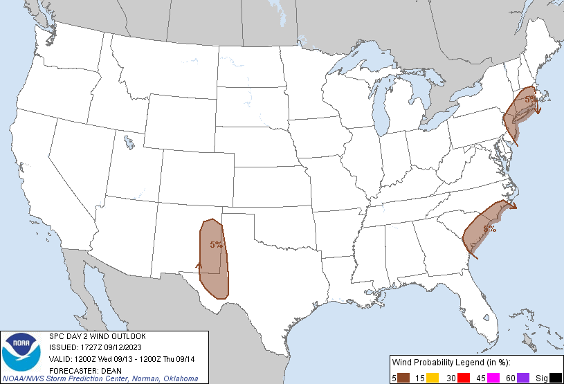
New York, NY...Newark, NJ...Jersey City, NJ...Yonkers, NY...Providence, RI...
Probabilistic Damaging Wind Graphic
Probability of damaging thunderstorm winds or wind gusts of 50 knots or higher within 25 miles of a point. Hatched Area: 10% of greater probability of wind gusts 65 knots or greater within 25 miles of a point.
Day 2 Wind Risk
Area (sq. mi.)
Area Pop.
Some Larger Population Centers in Risk Area
5 %
94,377
31,300,774
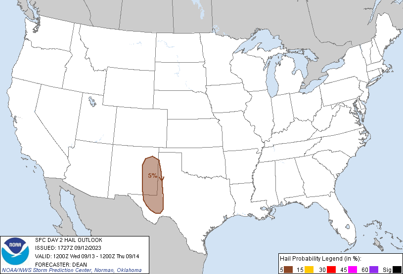
New York, NY...Newark, NJ...Jersey City, NJ...Yonkers, NY...Providence, RI...
Probabilistic Large Hail Graphic
Probability of hail 1" or larger within 25 miles of a point. Hatched Area: 10% or greater probability of hail 2" or larger within 25 miles of a point.
SPC AC 121727
Day 2 Convective Outlook
NWS Storm Prediction Center Norman OK
1227 PM CDT Tue Sep 12 2023
Valid 131200Z - 141200Z
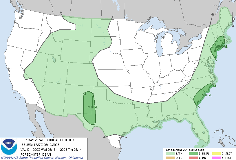
...THERE IS A MARGINAL RISK OF SEVERE THUNDERSTORMS FOR PARTS OF
SOUTHERN NEW ENGLAND...COASTAL CAROLINAS...SOUTHERN HIGH PLAINS...
...SUMMARY...
Marginally severe thunderstorms are possible in parts of the
southern High Plains, southern New England, and the Carolinas on
Wednesday.
...Synopsis...
An upper-level trough will move from the Great Lakes/Ohio Valley
toward New England on Wednesday. Multiple vorticity maxima will be
embedded within the midlevel southwesterly flow ahead of this
trough. At the surface, a cold front will move across parts of the
Northeast and Mid Atlantic into the southern Appalachians, with a
weak frontal wave potentially moving from the Mid Atlantic into New
England through the day. Farther west, a broad upper-level trough
will remain in place across parts of the western/central CONUS, with
one notable shortwave trough expected to move eastward from the
southern Rockies into the southern Plains.
...Northern NJ/Southeast NY into southern New England...
A band of convection will likely be ongoing at the start of the
forecast period somewhere across southeast NY/northern NJ into
western parts of southern New England, aided by low-level warm
advection and midlevel vorticity maxima ejecting northeastward ahead
of the primary upper trough. Instability will generally remain weak,
but moderate deep-layer shear, favorable moisture, and some
enhancement of low-level shear/SRH within the warm-advection regime
may support transient rotating cells capable of locally damaging
gusts and/or a brief tornado. The primary threat may reside with the
initial cluster of convection as it moves eastward across southern
New England, though some redevelopment will be possible its wake,
depending on timing of early convection and extent of
destabilization in its wake.
...Coastal Carolina vicinity...
In advance of the large-scale trough to the north, one or more weak
midlevel vorticity maxima may move across parts of the Carolinas
Wednesday. These may aid in scattered afternoon thunderstorm
development within a warm, moist, and moderately unstable
environment during the afternoon. Modest westerly midlevel flow will
support effective shear of 25-30 kt, sufficient for some storm
organization, and a few semi-organized cells/clusters will be
possible. A Marginal Risk has been added for parts of near-coastal
SC and southern NC, where the best overlap of instability, shear,
and storm coverage is currently anticipated.
...Southern High Plains vicinity...
Scattered thunderstorms are expected from the southern Rockies into
the High Plains Wednesday afternoon/evening, as a midlevel shortwave
trough traverses the region. Weak to moderate buoyancy and
sufficient deep-layer shear will support a few organized
cells/clusters capable of producing localized hail and severe gusts.
...Southeast AZ into southwest NM...
Scattered thunderstorm development will again be possible across
parts of southern AZ into southwest NM on Wednesday.
Moisture/instability may be somewhat weaker than D1/Tuesday, though
deep-layer shear will remain marginally sufficient for a few
semi-organized storms. Depending on the extent of D1 convection
across the region and its potential impact on D2 destabilization,
severe probabilities may eventually be needed.
..Dean.. 09/12/2023
CLICK TO GET WUUS02 PTSDY2 PRODUCT
NOTE: THE NEXT DAY 2 OUTLOOK IS SCHEDULED BY 0600Z