Omaha, NE...Minneapolis, MN...St. Paul, MN...Lincoln, NE...Sioux Falls, SD...
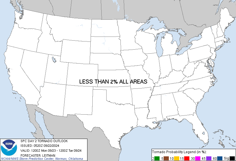
Probabilistic Tornado Graphic
Probability of a tornado within 25 miles of a point. Hatched Area: 10% or greater probability of EF2 - EF5 tornadoes within 25 miles of a point.
Day 2 Tornado Risk
Area (sq. mi.)
Area Pop.
Some Larger Population Centers in Risk Area
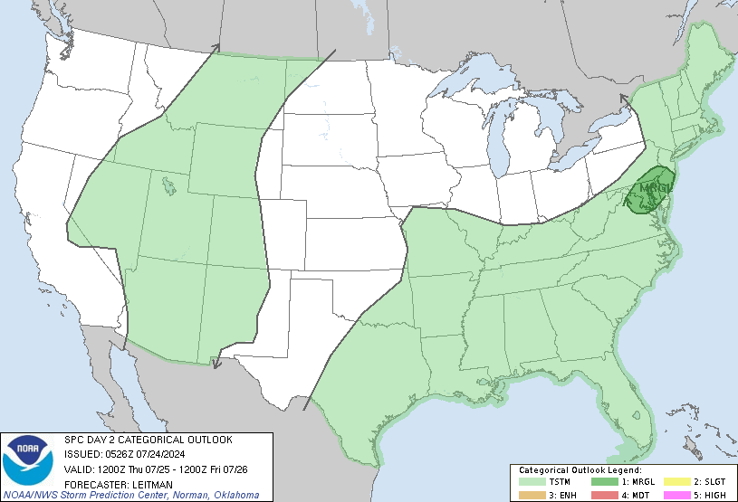
No Risk Areas Forecast
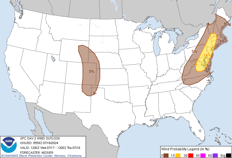
Probabilistic Damaging Wind Graphic
Probability of damaging thunderstorm winds or wind gusts of 50 knots or higher within 25 miles of a point. Hatched Area: 10% of greater probability of wind gusts 65 knots or greater within 25 miles of a point.
Omaha, NE...Minneapolis, MN...St. Paul, MN...Lincoln, NE...Sioux Falls, SD...
SPC AC 270559
Day 2 Convective Outlook
NWS Storm Prediction Center Norman OK
1259 AM CDT Sat Jul 27 2024
Valid 281200Z - 291200Z
...THERE IS A SLIGHT RISK OF SEVERE THUNDERSTORMS ACROSS CENTRAL
SOUTH DAKOTA...
...SUMMARY...
Scattered severe thunderstorms are expected across portions of the
central/northern Plains on Sunday.
...Synopsis...
An upper-level low across Arkansas/eastern Oklahoma will start to
fill and accelerate northeast as an open wave on Sunday. A low
amplitude mid-level trough will remain centered across the western
CONUS with several embedded mid-level impulses within moderate
southwesterly flow from the Great Basin to the northern Plains.
Farther east, a mid-level trough will become a cutoff low over the
Gulf Stream and start to retrograde toward the New England coast
late in the forecast period.
Persistent southwesterly mid-level flow will result in lee troughing
across the Plains and strengthening southerly surface flow. This
will bring renewed Gulf moisture northward into the Upper Midwest
and northern Plains.
...Central/Northern Plains...
A surface low will likely be located somewhere across western South
Dakota on Sunday and will only drift slightly east through the day.
East of this surface low, southerly winds will increase low-level
moisture with dewpoints increasing to the upper 60s/near 70 by 00Z.
By late afternoon, a warm front is forecast to become better defined
across north-central South Dakota which, in addition to the cold
front/dryline, should be a source for thunderstorm development as a
mid-level shortwave trough approaches the region during the
afternoon/evening. Moderate flow associated with this mid-level
shortwave trough should result in 35 to 40 knots of effective shear
by late afternoon which would be sufficient for supercells. Moderate
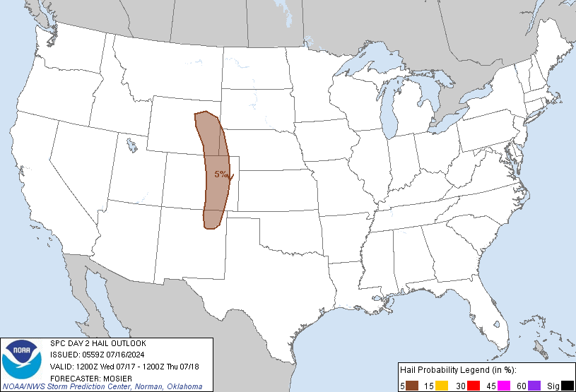
instability and moderate shear will support a large hail threat,
while inverted-v thermodynamic profiles will also support a severe
wind threat. The low-level jet axis is mostly southeast of the
greatest upper-level support and thus, upscale growth into an MCS
remains uncertain. However, storm coverage may be great enough for
upscale growth into one or more MCSs which could maintain some
severe weather threat into the overnight hours across southern
Minnesota and western Iowa where the low-level jet is forecast to
strengthen to 35 to 45 knots Sunday night.
A Slight Risk has been introduced across South Dakota, in proximity
to the mid-level shortwave trough, where greater storm coverage
appears likely. Elsewhere, northeast to the Canadian border and
farther south across Nebraska and northern Kansas, storm coverage
remains more questionable, which precludes higher probabilities at
this time.
..Bentley.. 07/27/2024
NOTE: THE NEXT DAY 2 OUTLOOK IS SCHEDULED BY 1730Z