|
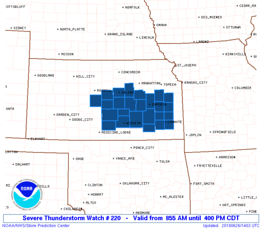
Initial List of Counties in SPC Severe Thunderstorm Watch 220 (WOU)
|
Back to Watch 220
|
 |
   WOUS64 KWNS 261356
   WOU0

   BULLETIN - IMMEDIATE BROADCAST REQUESTED
   SEVERE THUNDERSTORM WATCH OUTLINE UPDATE FOR WS 220
   NWS STORM PREDICTION CENTER NORMAN OK
   855 AM CDT TUE JUN 26 2018

   SEVERE THUNDERSTORM WATCH 220 IS IN EFFECT UNTIL 400 PM CDT
   FOR THE FOLLOWING LOCATIONS

   KSC001-003-009-015-017-031-041-049-053-059-073-079-095-111-113-
   115-127-133-139-155-159-169-173-205-207-262100-
   /O.NEW.KWNS.SV.A.0220.180626T1355Z-180626T2100Z/

   KS
   .    KANSAS COUNTIES INCLUDED ARE

   ALLEN                ANDERSON            BARTON
   BUTLER               CHASE               COFFEY
   DICKINSON            ELK                 ELLSWORTH
   FRANKLIN             GREENWOOD           HARVEY
   KINGMAN              LYON                MARION
   MCPHERSON            MORRIS              NEOSHO
   OSAGE                RENO                RICE
   SALINE               SEDGWICK            WILSON
   WOODSON


   ATTN...WFO...ICT...TOP...
|
| Aviation Watch (SAW) for WW220 |
|---|
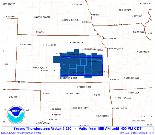 |
| Note:
The Aviation Watch (SAW) product is an approximation to the watch area.
The actual watch is depicted by the shaded areas. |
   SAW0
   WW 220 SEVERE TSTM KS 261355Z - 262100Z
   AXIS..40 STATUTE MILES NORTH AND SOUTH OF LINE..
   30W HUT/HUTCHINSON KS/ - 30NE CNU/CHANUTE KS/
   ..AVIATION COORDS.. 35NM N/S /44WNW ICT - 33WSW BUM/
   HAIL SURFACE AND ALOFT..2 INCHES. WIND GUSTS..60 KNOTS.
   MAX TOPS TO 550. MEAN STORM MOTION VECTOR 27025.

   LAT...LON 38659841 38569508 37409508 37499841

   THIS IS AN APPROXIMATION TO THE WATCH AREA.  FOR A
   COMPLETE DEPICTION OF THE WATCH SEE WOUS64 KWNS
   FOR WOU0.
|
|


 @NWSSPC
