(All days are valid from 12 UTC - 12 UTC the following day)
Note: A severe weather area depicted in the Day 4-8 period indicates 15%, 30% or higher probability for severe thunderstorms within 25 miles of any point.
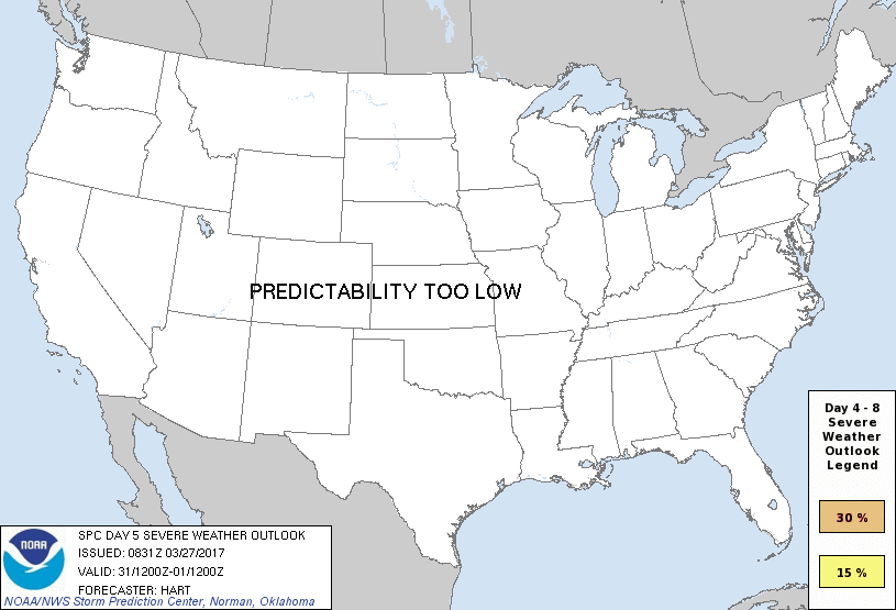
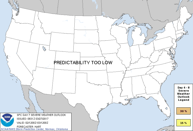
PREDICTABILITY TOO LOW is used to indicate severe storms may be possible based on some model scenarios. However, the location or occurrence of severe storms are in doubt due to: 1) large differences in the deterministic model solutions, 2) large spread in the ensemble guidance, and/or 3) minimal run-to-run continuity.
POTENTIAL TOO LOW means the threat for a regional area of organized severe storms appears unlikely (i.e., less than 15%) for the forecast day.
Forecast Discussion
ZCZC SPCSWOD48 ALL
ACUS48 KWNS 270831
SPC AC 270831
Day 4-8 Convective Outlook
NWS Storm Prediction Center Norman OK
0331 AM CDT Mon Mar 27 2017
Valid 301200Z - 041200Z
...DISCUSSION...
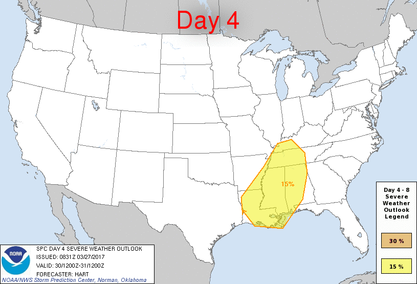
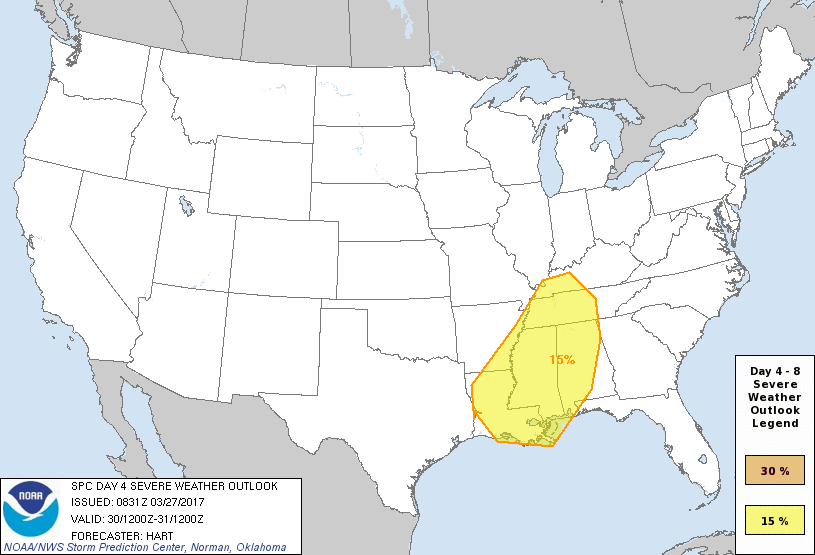
...Day4 Thu - LA/MS/AL/TN/KY...
The string of consecutive days of active severe weather will
potentially continue on Thursday as the large upper trough over the
Plains shifts slowly eastward. Storms will likely be ongoing
Thursday morning from western LA into western KY, and will track
northeastward into parts of KY/TN/MS/AL through the period. Strong
wind fields and sufficient moisture/instability will promote the
risk of severe storms, and some model solutions indicate the
potential for a more widespread event. However, uncertainties due
to Day2/Day3 convection and differences in the 00z operational model
suite limit confidence to a 15% risk area for Day4.
...Day 5 Fri - GA/Carolinas...
The shortwave trough that will affect MS/AL on Thursday will move
eastward and affect the Carolinas on Friday. Dewpoints in the 60s
and ample mid level westerly flow suggest a risk of severe storms.
However, model consistency regarding the timing/strength of this
upper system becomes relatively low by Day5, so will not include a
risk area at this time.
..Day7 Sun/Day8 Mon - TX/OK...
The next upper system will track into the Southern Plains beginning
Saturday, with low level moisture streaming back northward and the
risk of thunderstorms increasing across parts of TX/OK. Model
consistency is reasonably high with this system into Sat. However,
divergence of solutions beyond F120 eliminates confidence in adding
a severe risk area on Days 7/8 over TX. Nevertheless, it seems
likely that risk areas will eventually be needed for parts of this
region.
..Hart.. 03/27/2017
CLICK TO GET WUUS48 PTSD48 PRODUCT


 @NWSSPC