(All days are valid from 12 UTC - 12 UTC the following day)
Note: A severe weather area depicted in the Day 4-8 period indicates 15%, 30% or higher probability for severe thunderstorms within 25 miles of any point.
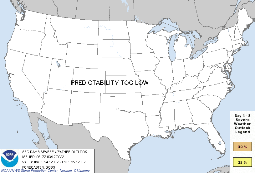
PREDICTABILITY TOO LOW is used to indicate severe storms may be possible based on some model scenarios. However, the location or occurrence of severe storms are in doubt due to: 1) large differences in the deterministic model solutions, 2) large spread in the ensemble guidance, and/or 3) minimal run-to-run continuity.
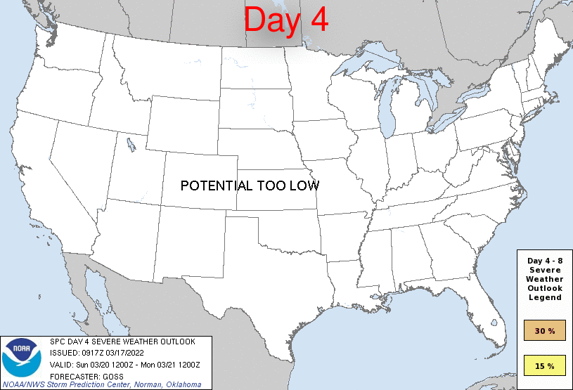
POTENTIAL TOO LOW means the threat for a regional area of organized severe storms appears unlikely (i.e., less than 15%) for the forecast day.
Forecast Discussion
ZCZC SPCSWOD48 ALL
ACUS48 KWNS 170917
SPC AC 170917
Day 4-8 Convective Outlook
NWS Storm Prediction Center Norman OK
0417 AM CDT Thu Mar 17 2022
Valid 201200Z - 251200Z
...DISCUSSION...
Models continue to depict likelihood for a multi-day -- and
potentially widespread -- severe weather episode across the
south-central and southeastern U.S. through the first part of next
week. Deterministic global models, as well as both GEFS and ECMWF
ensemble means, are in good agreement with pattern evolution through
Day 6 and into Day 7, lending confidence to the evolving scenario.
Day 4/Sunday, a digging upper trough will shift across the western
U.S., with a closed low expected to evolve over New Mexico vicinity
overnight. Low-level moisture will be returning into the southern
Plains at this point, but in an incomplete manner, and thus any risk
for severe weather late Sunday night/Monday morning should remain
rather low, and likely confined primarily to hail with elevated
overnight storms.
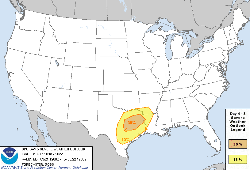
By Day 5/Monday, as the upper low moves northeastward across New
Mexico toward the High Plains, a surface low is forecast to evolve
over western Texas, and move toward western Oklahoma. As this
occurs, continued advection of high theta-e Gulf air into roughly
the eastern half of Texas will occur ahead of an advancing cold
front. As the airmass diurnally destabilizes, an increase in storm
coverage an intensity is expected. With very strong
southwesterly/south-southwesterly flow aloft, atop
south-southeasterlies at low levels, deep-layer shear will favor
supercells, along with sufficient low-level shear to support
potential for tornadoes -- a few possibly strong. Large hail and
damaging winds are also expected.
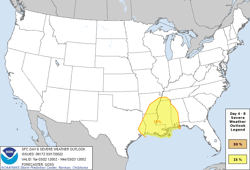
As the upper system makes only slow eastward progress Day 6/Tuesday,
another day of severe weather is expected, displaced somewhat to the
east as the surface front progresses. Continued influx of Gulf
moisture into the warm sector will permit ample CAPE to develop,
while strong low-level and deep-layer shear will again be present
across the warm sector. This will again favor an all-hazards severe
event, including tornado potential, that will continue through the
evening and into the overnight period.
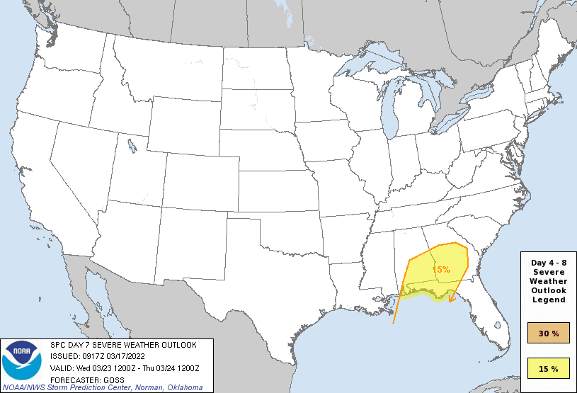
The severe-weather risk will likely continue into Wednesday/Day 7,
as a portion of the larger-scale upper trough ejects northeastward
across the Mid South and Ohio Valley. With forcing/large-scale
ascent likely to become somewhat displaced from the more favorably
moist/unstable airmass to the south, severe potential may be
slightly less than prior days. Still, with favorable shear across a
moist pre-frontal airmass from the southern Appalachians southward,
severe storms are expected once again.
By Thursday, models begin to deviate in terms of both upper-level
and surface pattern evolution, and thus any convective/severe risk
across Florida and adjacent areas appears difficult to quantify due
to predictability issues.
..Goss.. 03/17/2022
CLICK TO GET WUUS48 PTSD48 PRODUCT


 @NWSSPC