|
| Mesoscale Discussion 150 |
|
< Previous MD Next MD >
|

|
   Mesoscale Discussion 0150
   NWS Storm Prediction Center Norman OK
   0251 PM CST Sun Mar 03 2019

   Areas affected...central GA

   Concerning...Tornado Watch 8...

   Valid 032051Z - 032115Z

   The severe weather threat for Tornado Watch 8 continues.

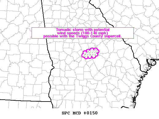
   SUMMARY...Tornadic storms with potential tornadic wind speeds
   100-140mph are possible with the Twiggs County supercell.

   DISCUSSION...KFFC radar imagery indicates rotational velocity values
   between 45-60 kt with an environment supportive of tornadic
   supercells.  Experimental tornado damage intensity guidance is
   suggestive of wind speeds between 100-140mph.  Downstream of this
   storm, expecting little to no storm-scale interference in the near
   term in a strong low-level shear environment.  As other storms over
   south-central GA move north into the warm frontal zone over central
   GA, the tornado potential will probably increase.

   ..Smith.. 03/03/2019

   ...Please see www.spc.noaa.gov for graphic product...

   ATTN...WFO...FFC...

   LAT...LON   32798363 32928333 32938298 32708306 32658358 32798363
|
|
Top/All Mesoscale Discussions/Forecast Products/Home
|
|


