|
| Mesoscale Discussion 1645 |
|
< Previous MD Next MD >
|
|
Mesoscale Discussion 1645
NWS Storm Prediction Center Norman OK
1149 AM CDT Mon Aug 05 2019
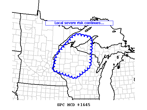
Areas affected...parts of northern Wisconsin and into Upper Michigan
Concerning...Severe Thunderstorm Watch 552...
Valid 051649Z - 051845Z
The severe weather threat for Severe Thunderstorm Watch 552
continues.
SUMMARY...Storms -- and local severe risk -- persist across
remaining portions of WW 552.
DISCUSSION...Latest radar loop shows some weakening/decreased
organization with the band of storms moving across eastern portions
of WW 552 -- i.e. across northwestern Wisconsin -- at this time.
However, the downstream airmass -- both east and south of the
convection -- continues to destabilize as diurnal heating pushes
temperatures into 80s. Though short-term trends, with respect to
severe potential into Upper Michigan and a greater portion of
northern Wisconsin, suggest lessened risk over the next hour or so,
we will continue to monitor this convection for signs that continued
downstream destabilization begins to aid in a re-intensification of
storms, which could require new WW issuance.
..Goss.. 08/05/2019
...Please see www.spc.noaa.gov for graphic product...
ATTN...WFO...MQT...GRB...DLH...ARX...MPX...
LAT...LON 44769273 45929249 47509055 47559008 47308850 45078876
44179035 44769273
|
|
Top/All Mesoscale Discussions/Forecast Products/Home
|
|


 @NWSSPC