|
| Mesoscale Discussion 2091 |
|
< Previous MD Next MD >
|
|
Mesoscale Discussion 2091
NWS Storm Prediction Center Norman OK
0908 PM CDT Sun Oct 20 2019
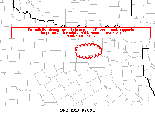
Areas affected...North Dallas Metropolitan Area
Concerning...Tornado Watch 676...
Valid 210208Z - 210245Z
The severe weather threat for Tornado Watch 676 continues.
SUMMARY...Tornado is currently ongoing across northern Dallas
County. The environment is supportive of a strong tornado, with
additional tornadoes possible downstream in the next hour or so.
DISCUSSION...Recent radar signatures from KFWS reveal an intense
supercell characterized by a 0.5 degree rotational velocity between
60 and 65 kt. A tornadic debris signature has also been noted on
recent radar scans. This signature is occurring in an environment
characterized by STP between 3 and 4. Previous signatures within
similar environments produced damage-estimated wind speeds from 120
to 160 mph and a confidence is high for an intense tornado.
..Squitieri/Grams.. 10/21/2019
...Please see www.spc.noaa.gov for graphic product...
ATTN...WFO...FWD...
LAT...LON 32879602 32779632 32769683 32909703 33059702 33139702
33169684 33219651 33189612 32979590 32879602
|
|
Top/All Mesoscale Discussions/Forecast Products/Home
|
|


 @NWSSPC