|
| Mesoscale Discussion 329 |
|
< Previous MD Next MD >
|
|
Mesoscale Discussion 0329
NWS Storm Prediction Center Norman OK
0824 PM CDT Fri Mar 24 2023
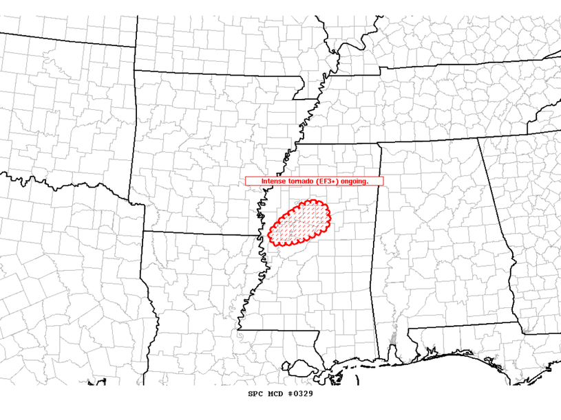
Areas affected...North-central MS
Concerning...Tornado Watch 76...
Valid 250124Z - 250215Z
CORRECTED FOR ERROR IN SPATIAL DELINEATION
The severe weather threat for Tornado Watch 76 continues.
SUMMARY...An intense tornado (EF3+) is likely ongoing with a
supercell tracking northeastward across western Sharkley County MS,
and this storm should persist for the next 30-60 min.
DISCUSSION...Latest radar data shows an organized cyclonic supercell
tracking northeastward across western Sharkley County MS, with a
VROT above 70 kt and well-defined TDS up to 13k ft -- indicative of
an intense tornado (EF3+) given the parameter space (STP of 4). The
downstream environment features a large, clockwise-curved hodograph
per DGX VWP (around 430 m2/s2 0-1 km SRH) amid rich boundary-layer
moisture. This will support the maintenance of this intense
supercell toward the northeast for the next 30-60 min.
..Weinman.. 03/25/2023
...Please see www.spc.noaa.gov for graphic product...
ATTN...WFO...JAN...
LAT...LON 33109089 33379060 33659013 33758990 33688961 33548947
33218950 33098973 32969006 32889039 32859067 32879088
33109089
|
|
Top/All Mesoscale Discussions/Forecast Products/Home
|
|


 @NWSSPC