|
| Day 4-8 Severe Weather Outlook Issued on Oct 8, 2012 |
| Updated: Mon Oct 8 08:56:03 UTC 2012 |
 |
| D4 | Thu, Oct 11, 2012 - Fri, Oct 12, 2012 |
D7 | Sun, Oct 14, 2012 - Mon, Oct 15, 2012 |
| D5 | Fri, Oct 12, 2012 - Sat, Oct 13, 2012 |
D8 | Mon, Oct 15, 2012 - Tue, Oct 16, 2012 |
| D6 | Sat, Oct 13, 2012 - Sun, Oct 14, 2012 |
(All days are valid from 12 UTC - 12 UTC) |
|
Note: A severe weather area depicted in the Day 4-8 period indicates a 30% or higher probability for severe thunderstorms within 25 miles of any point.
|
|
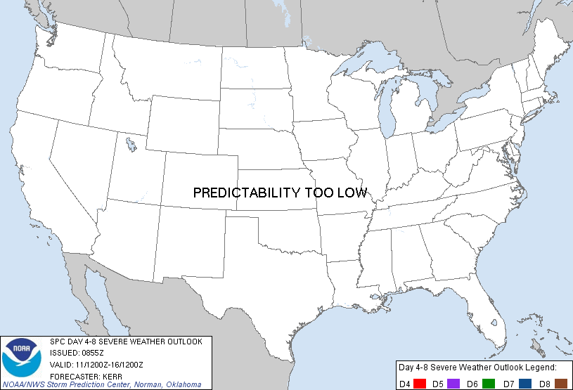
PREDICTABILITY TOO LOW is used to indicate severe storms may be possible based on some model scenarios. However, the location or occurrence of severe storms are in doubt due to: 1) large differences in the deterministic model solutions, 2) large spread in the ensemble guidance, and/or 3) minimal run-to-run continuity.
|
|
POTENTIAL TOO LOW means the threat for a regional area of organized severe storms appears highly unlikely during the entire period (e.g. less than a 30% probability for a regional severe storm area across the CONUS through the entire Day 4-8 period).
|
   ZCZC SPCSWOD48 ALL
   ACUS48 KWNS 080855
   SPC AC 080855

   DAY 4-8 CONVECTIVE OUTLOOK
   NWS STORM PREDICTION CENTER NORMAN OK
   0355 AM CDT MON OCT 08 2012

   VALID 111200Z - 161200Z

   ...DISCUSSION...
   MEDIUM RANGE MODELS CONTINUE TO INDICATE THE TRANSITION TO A MORE
   ZONAL/PROGRESSIVE UPPER FLOW REGIME LATE THIS COMING WORK WEEK INTO
   NEXT WEEKEND.  AS THIS OCCURS...A CLOSED LOW...MIGRATING INLAND
   ACROSS THE CALIFORNIA COAST BY MID WEEK...APPEARS LIKELY TO RAPIDLY
   ACCELERATE EAST NORTHEASTWARD OUT OF THE SOUTHWESTERN STATES.  AND
   IT IS APPEARING INCREASINGLY LIKELY THAT THIS WILL BE ACCOMPANIED BY
   SIGNIFICANT SURFACE CYCLOGENESIS FROM THE LEE OF THE CENTRAL ROCKIES
   THROUGH THE GREAT LAKES AND EASTERN CANADA.  GUIDANCE HAS BEEN
   SUGGESTIVE THAT UPWARD VERTICAL MOTION...DEEP LAYER FLOW FIELDS AND
   VERTICAL SHEAR WILL BE MOST SUPPORTIVE OF SEVERE WEATHER POTENTIAL
   IN THE WARM SECTOR OF THIS SYSTEM ON SATURDAY.  THIS SEEMS MOST
   PROBABLE ACROSS PARTS OF EASTERN NEBRASKA AND KANSAS...NORTHEAST
   OKLAHOMA...THE NORTHWESTERN THIRDS OF MISSOURI...IOWA AND ADJACENT
   NORTHWEST ILLINOIS...SOUTHWESTERN WISCONSIN AND SOUTHERN MINNESOTA.
   HOWEVER...THIS TIME FRAME ALSO COINCIDES WITH A SIGNIFICANT INCREASE
   IN SPREAD AMONG MODEL ENSEMBLE DATA...PARTICULARLY CONCERNING THE
   SPEED OF THE UPPER IMPULSE.  QUESTIONS ALSO LINGER CONCERNING THE
   DEGREE OF WARM SECTOR BOUNDARY LAYER DESTABILIZATION...WHICH COULD
   BE IMPACTED SIGNIFICANTLY BY PRIOR CONVECTION.  TOO MUCH UNCERTAINTY
   STILL EXISTS TO CONFIDENTLY ASSESS THE POTENTIAL FOR A REGIONAL
   SEVERE WEATHER EVENT.

   ..KERR.. 10/08/2012

   CLICK TO GET WUUS48 PTSD48 PRODUCT
|
|


 @NWSSPC