|
| Mesoscale Discussion 241 |
|
< Previous MD
Next MD >
|
|
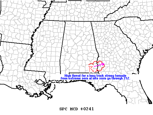
   MESOSCALE DISCUSSION 0241
   NWS STORM PREDICTION CENTER NORMAN OK
   0140 PM CST THU MAR 01 2007

   AREAS AFFECTED...SERN AL AND SWRN GA

   CONCERNING...SEVERE THUNDERSTORM WATCH 46...

   VALID 011940Z - 012045Z

   HP SUPERCELL IN DALE COUNTY OF SERN AL WILL POSE A HIGH RISK OF A
   LONG TRACK STRONG TORNADO AND VERY LARGE HAIL AS IT CONTINUES ENE AT
   37 KT. A TORNADO HAS ALREADY BEEN CONFIRMED EARLIER WITH THIS STORM
   IN COFFEE COUNTY. THIS STORM HAS DEVELOPED ALONG THE SRN END OF A
   LARGER CLUSTER OF STORMS WHERE THE LOW LEVEL MOIST UNSTABLE INFLOW
   IS RELATIVELY UNIMPEDED. THE SUPERCELL WILL MOVE THROUGH PARTS OF
   HENRY COUNTY IN SERN AL AND CROSS THE GA BORDER INTO EARLY AND CLAY
   COUNTIES AROUND 2030Z.

   ..DIAL.. 03/01/2007


   ATTN...WFO...TAE...

   31348468 31258546 31318581 31518575 31788475
|
|
Top/All Mesoscale Discussions/Forecast Products/Home
|
|


 @NWSSPC