Skip Navigation Links weather.gov 
NOAA logo-Select to go to the NOAA homepage NOAA's National Weather Service   Select to go to the NWS homepage
Storm Prediction Center
navigation bar left  
  navigation bar end cap


USA.gov is the U.S. Government's official Web portal to all Federal, state and local government Web resources and services.

Mesoscale Discussion 2219
< Previous MD         Next MD >
MD 2219 graphic
   
   MESOSCALE DISCUSSION 2219
   NWS STORM PREDICTION CENTER NORMAN OK
   0434 PM CST TUE DEC 25 2012
   
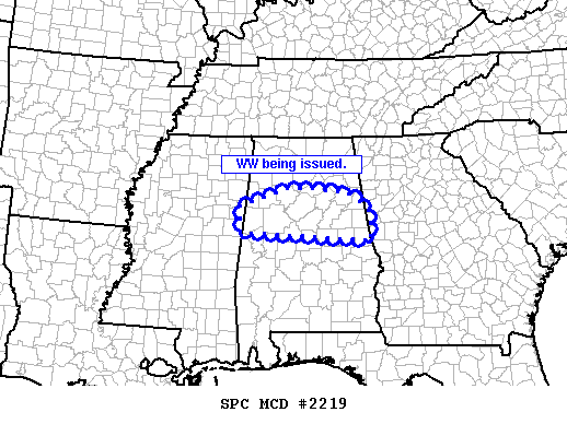
   AREAS AFFECTED...CNTRL AL
   
   CONCERNING...SEVERE POTENTIAL...WATCH NEEDED SOON 
   
   VALID 252234Z - 252300Z
   
   PROBABILITY OF WATCH ISSUANCE...95 PERCENT
   
   SUMMARY...NEW SEVERE TSTM WATCH WILL BE ISSUED SHORTLY FOR PORTIONS
   OF CNTRL AL.
   
   DISCUSSION...NRN PORTION OF QLCS HAS ACCELERATED EWD WITH A DISTINCT
   BOWING SEGMENT. ALTHOUGH WELL N OF THE SURFACE WARM FRONT THAT
   EXTENDS FROM S OF MEI TO NEAR DHN...INTENSE WIND FIELDS MAY SUPPORT
   PENETRATIVE DOWNDRAFTS CAPABLE OF ISOLATED DAMAGING WINDS.
   
   ..GRAMS/HART.. 12/25/2012
   
   
   ATTN...WFO...FFC...BMX...HUN...JAN...
   
   LAT...LON   33558839 33948731 33948661 33858577 33588531 33408522
               32838517 33018839 33558839 
   
Top/All Mesoscale Discussions/Forecast Products/Home
Weather Topics:
Watches, Mesoscale Discussions, Outlooks, Fire Weather, All Products, Contact Us

NOAA / National Weather Service
National Centers for Environmental Prediction
Storm Prediction Center
120 David L. Boren Blvd.
Norman, OK 73072 U.S.A.
spc.feedback@noaa.gov
Page last modified: January 01, 1970
Disclaimer
Information Quality
Help
Glossary
Privacy Policy
Freedom of Information Act (FOIA)
About Us
Career Opportunities