Mesoscale Discussion 0803
NWS Storm Prediction Center Norman OK
0554 PM CDT Sat May 29 2021
Areas affected...East-central/southeast CO
Concerning...Tornado Watch 223...
Valid 292254Z - 300000Z
The severe weather threat for Tornado Watch 223 continues.
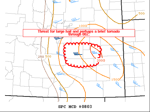
SUMMARY...Large hail and a brief tornado will be possible through
00Z.
DISCUSSION...At 2245Z, a cluster of strong thunderstorms is ongoing
across El Paso County CO, with additional rapid development noted
across southern Lincoln County, in the vicinity of multiple boundary
intersections. The Lincoln County convection could evolve into a
supercell or two, given moderate instability and sufficient
effective shear in place. Hail would be the primary threat, though a
brief tornado will be possible with any intense updraft interacting
with the boundaries that are in the vicinity.
Further west across El Paso County, storms may struggle to move
eastward as outflow spreads will ahead of the convection, but
redevelopment remains possible near and south of Colorado Springs,
with a continued risk of hail into this evening.
..Dean.. 05/29/2021
...Please see www.spc.noaa.gov for graphic product...
ATTN...WFO...PUB...BOU...
LAT...LON 39070492 39080381 38950317 38300338 38220426 38320480
38610492 38790495 39070492
|


 @NWSSPC