|
| Mesoscale Discussion 479 |
|
< Previous MD Next MD >
|
|
Mesoscale Discussion 0479
NWS Storm Prediction Center Norman OK
0526 PM CDT Sun May 02 2021
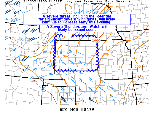
Areas affected...Portions of western/central KS
Concerning...Severe potential...Severe Thunderstorm Watch likely
Valid 022226Z - 022330Z
Probability of Watch Issuance...95 percent
SUMMARY...Severe threat, including the potential for significant
severe wind gusts, will likely continue to increase early this
evening. A Severe Thunderstorm Watch will likely be issued.
DISCUSSION...Convection has recently begun to form along a surface
front in north-central KS as low-level convergence gradually
increases late this afternoon. Additional robust storm development
will likely occur/form along the KS/CO border and subsequently
spread eastward. As this activity encounters increasing low-level
moisture and rather well mixed airmass, damaging/severe wind gusts
will likely become the main threat very quickly. Isolated large hail
may also occur. Given the deeply mixed boundary layer and convection
likely to focus along the surface front and grow upscale quickly,
significant severe wind gusts appear possible. A Severe Thunderstorm
Watch will be issued soon to address this increasing threat.
..Gleason/Thompson.. 05/02/2021
...Please see www.spc.noaa.gov for graphic product...
ATTN...WFO...ICT...GID...DDC...GLD...
LAT...LON 40290201 40299797 37809794 37750198 40290201
|
|
Top/All Mesoscale Discussions/Forecast Products/Home
|
|


 @NWSSPC