|
| Mesoscale Discussion 1985 |
|
< Previous MD Next MD >
|
|
Mesoscale Discussion 1985
NWS Storm Prediction Center Norman OK
0552 PM CST Fri Dec 10 2021
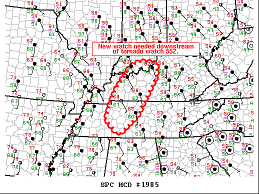
Areas affected...Portions of western Kentucky and Middle Tennessee.
Concerning...Severe potential...Tornado Watch likely
Valid 102352Z - 110115Z
Probability of Watch Issuance...95 percent
SUMMARY...A new tornado watch is needed downstream of tornado watch
552.
DISCUSSION...Warm air advection showers have started producing
lightning across portions of southern Illinois and western Kentucky.
Expect a slow increase in storm coverage and intensity across this
region. This activity (including a tornado warned storm entering
Calloway County, Kentucky) will move east of tornado watch 552 in
the next 30 to 60 minutes. The HPX VWP shows a very favorable
low-level shear environment with 0-1 km SRH around 400 m2/s2
indicating the potential for strong tornadoes. Therefore a
downstream tornado watch will be needed. The eastward extent of the
threat will be limited due to decreasing instability, but at least
some threat is expected to near I-65. This area will likely need to
be in a watch for an extended period due to multiple rounds of
convection continuing for most of the night.
..Bentley/Grams.. 12/10/2021
...Please see www.spc.noaa.gov for graphic product...
ATTN...WFO...LMK...OHX...PAH...MEG...
LAT...LON 38208699 38428644 38408549 37798549 35988660 35158758
35848828 36978790 38208699
|
|
Top/All Mesoscale Discussions/Forecast Products/Home
|
|


 @NWSSPC