|
| Mesoscale Discussion 1050 |
|
< Previous MD Next MD >
|
|
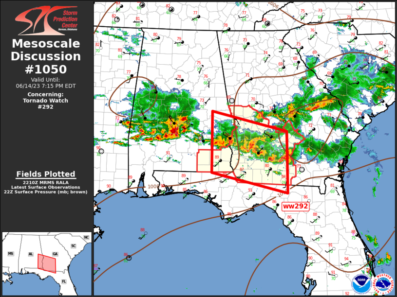
   Mesoscale Discussion 1050
   NWS Storm Prediction Center Norman OK
   0513 PM CDT Wed Jun 14 2023

   Areas affected...Southeast Alabama...Southwest Georgia

   Concerning...Tornado Watch 292...

   Valid 142213Z - 142315Z

   The severe weather threat for Tornado Watch 292 continues.

   SUMMARY...Tornado Watch 292 will be replaced by 23z across southeast
   Alabama and southwest Georgia.

   DISCUSSION...Severe convection has only propagated across the
   northern third of ww292. Given the current speed/movement, most of
   the southern half of the watch will not experience appreciable
   convection prior to 23z watch expiration. Strong shear, steep lapse
   rates, and strong buoyancy remain favorable for supercells sagging
   south toward the FL border later this evening. New tornado watch
   will be issued soon to account for these trends.

   ..Darrow.. 06/14/2023

   ...Please see www.spc.noaa.gov for graphic product...

   ATTN...WFO...JAX...FFC...TAE...BMX...

   LAT...LON   30978570 32718570 32138324 30408324 30978570
|
|
Top/All Mesoscale Discussions/Forecast Products/Home
|
|


 @NWSSPC