|
| Mesoscale Discussion 1622 |
|
< Previous MD Next MD >
|
|
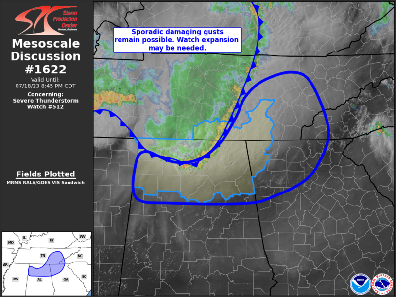
   Mesoscale Discussion 1622
   NWS Storm Prediction Center Norman OK
   0546 PM CDT Tue Jul 18 2023

   Areas affected...northern Alabama...eastern Tennessee...northwest
   Georgia

   Concerning...Severe Thunderstorm Watch 512...

   Valid 182246Z - 190145Z

   The severe weather threat for Severe Thunderstorm Watch 512
   continues.

   SUMMARY...Locally damaging gusts will remain possible from northern
   Alabama into eastern Tennessee, and perhaps far northwest Georgia.
   While the severe threat may extend east of WW 512, eastward extent
   appears limited.

   DISCUSSION...An MCS with expansive outflow continues to move
   east/southeast across Middle TN and now into northern AL where the
   strongest cells exist. Recently, wind gusts of 45-52 kt have been
   measured over northern AL and far southern TN. Surface observations
   indicate much drier air near the Atlanta area and points east, with
   objective analysis indicating an MLCAPE drop of over 1000 J/kg
   between Huntsville and Atlanta.

   Western portions of the line will continue to interact with the
   stronger instability, but the line orientation appears less
   favorable for anything but a localized severe threat. Later this
   evening, a conditional risk of additional severe gusts will exist
   should the MCS near Memphis remain intact.

   ..Jewell.. 07/18/2023

   ...Please see www.spc.noaa.gov for graphic product...

   ATTN...WFO...GSP...MRX...FFC...OHX...BMX...HUN...MEG...

   LAT...LON   33918494 33778558 33768726 33858811 34488815 34748794
               34568729 34608672 34928620 35438583 35828562 36128520
               36298452 36078406 35178367 34528392 34188428 33918494
|
|
Top/All Mesoscale Discussions/Forecast Products/Home
|
|


 @NWSSPC