Note:
The expiration time in the watch graphic is amended if the watch is
replaced, cancelled or extended.
Note:
Note:
The expiration time in the watch graphic is amended if the watch is
replaced, cancelled or extended.
Note: Click for
Watch Status Reports.
SEL2
URGENT - IMMEDIATE BROADCAST REQUESTED
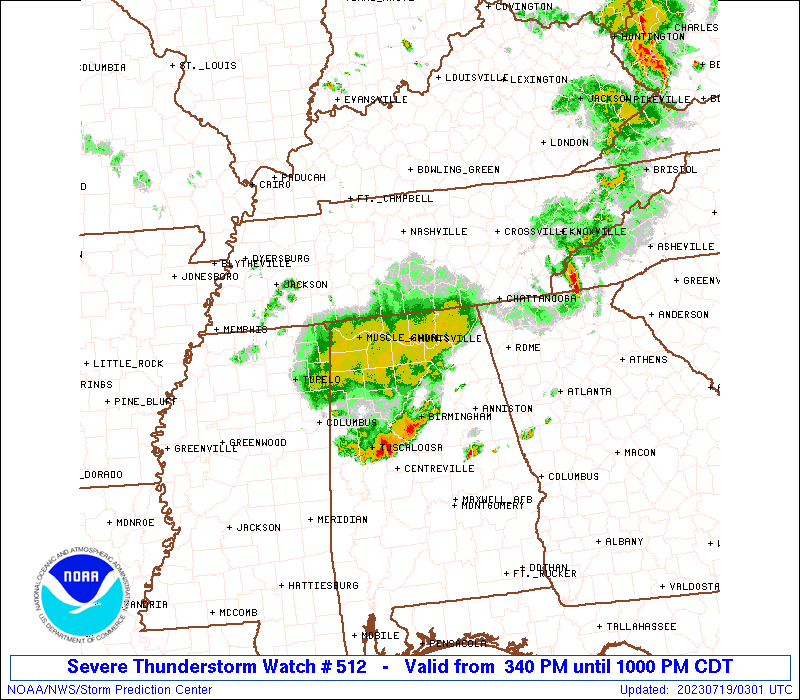
Severe Thunderstorm Watch Number 512
NWS Storm Prediction Center Norman OK
340 PM CDT Tue Jul 18 2023
The NWS Storm Prediction Center has issued a
* Severe Thunderstorm Watch for portions of
Northern Alabama
Northwest Georgia
Middle Tennessee
* Effective this Tuesday afternoon and evening from 340 PM until
1000 PM CDT.
* Primary threats include...
Scattered damaging wind gusts to 70 mph possible
Isolated large hail events to 1.5 inches in diameter possible
A tornado or two possible
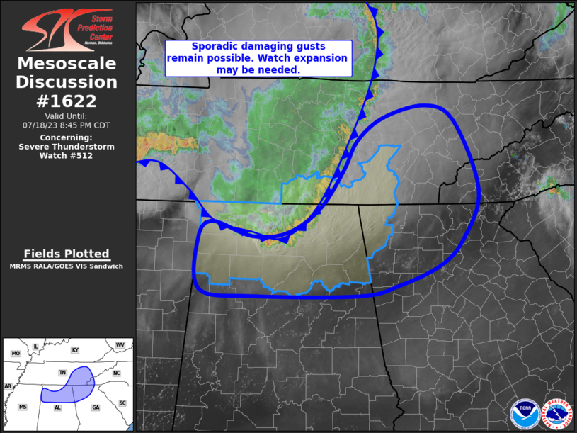
SUMMARY...A line of severe thunderstorms will continue moving
east-southeast across the watch area through this evening with a
risk for damaging wind gusts and isolated large hail. A tornado or
two will also be possible.
The severe thunderstorm watch area is approximately along and 40
statute miles north and south of a line from 35 miles southwest of
Muscle Shoals AL to 15 miles south of Chattanooga TN. For a complete
depiction of the watch see the associated watch outline update
(WOUS64 KWNS WOU2).
PRECAUTIONARY/PREPAREDNESS ACTIONS...
REMEMBER...A Severe Thunderstorm Watch means conditions are
favorable for severe thunderstorms in and close to the watch area.
Persons in these areas should be on the lookout for threatening
weather conditions and listen for later statements and possible
warnings. Severe thunderstorms can and occasionally do produce
tornadoes.
&&
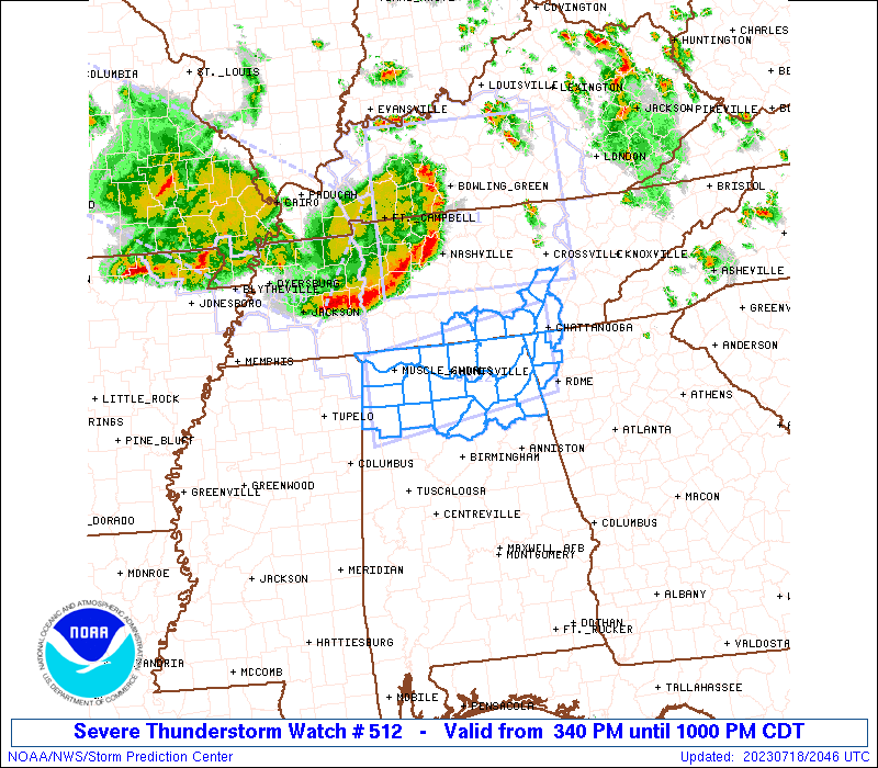
OTHER WATCH INFORMATION...CONTINUE...WW 510...WW 511...
AVIATION...A few severe thunderstorms with hail surface and aloft to
1.5 inches. Extreme turbulence and surface wind gusts to 60 knots. A
few cumulonimbi with maximum tops to 550. Mean storm motion vector
28040.
...Bunting
 Note:
The Aviation Watch (SAW) product is an approximation to the watch area.
The actual watch is depicted by the shaded areas.
Note:
The Aviation Watch (SAW) product is an approximation to the watch area.
The actual watch is depicted by the shaded areas.
SAW2
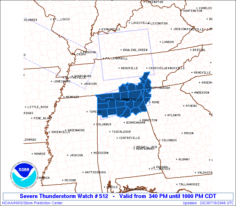
WW 512 SEVERE TSTM AL GA TN 182040Z - 190300Z
AXIS..40 STATUTE MILES NORTH AND SOUTH OF LINE..
35SW MSL/MUSCLE SHOALS AL/ - 15S CHA/CHATTANOOGA TN/
..AVIATION COORDS.. 35NM N/S /34WSW MSL - 9SSW GQO/
HAIL SURFACE AND ALOFT..1.5 INCHES. WIND GUSTS..60 KNOTS.
MAX TOPS TO 550. MEAN STORM MOTION VECTOR 28040.
LAT...LON 34978805 35398520 34238520 33818805
THIS IS AN APPROXIMATION TO THE WATCH AREA. FOR A
COMPLETE DEPICTION OF THE WATCH SEE WOUS64 KWNS
FOR WOU2.
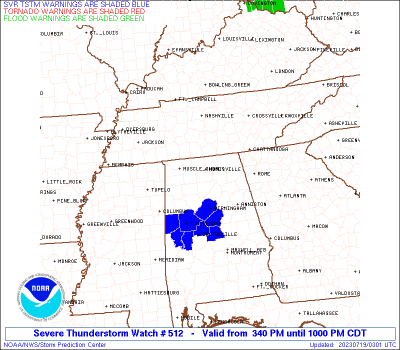
Watch 512 Status Report Messages:
STATUS REPORT #1 ON WW 512

VALID 190055Z - 190140Z

SEVERE WEATHER THREAT CONTINUES RIGHT OF A LINE FROM 40 WNW MSL
TO 25 E CHA.

..JEWELL..07/19/23

ATTN...WFO...BMX...HUN...FFC...MRX...

&&

STATUS REPORT FOR WS 512

SEVERE WEATHER THREAT CONTINUES FOR THE FOLLOWING AREAS

ALC009-019-033-043-049-055-057-059-071-075-077-079-083-089-093-
095-103-127-133-190140-

AL
.    ALABAMA COUNTIES INCLUDED ARE

BLOUNT		     CHEROKEE		 COLBERT
CULLMAN 	     DEKALB		 ETOWAH
FAYETTE 	     FRANKLIN		 JACKSON
LAMAR		     LAUDERDALE 	 LAWRENCE
LIMESTONE	     MADISON		 MARION
MARSHALL	     MORGAN		 WALKER
WINSTON
$$


THE WATCH STATUS MESSAGE IS FOR GUIDANCE PURPOSES ONLY.  PLEASE
REFER TO WATCH COUNTY NOTIFICATION STATEMENTS FOR OFFICIAL
INFORMATION ON COUNTIES...INDEPENDENT CITIES AND MARINE ZONES
CLEARED FROM SEVERE THUNDERSTORM AND TORNADO WATCHES.
$$
Note:
Click for Complete Product Text.
Tornadoes
Probability of 2 or more tornadoes
|
Low (20%)
|
Probability of 1 or more strong (EF2-EF5) tornadoes
|
Low (<2%)
|
Wind
Probability of 10 or more severe wind events
|
Mod (40%)
|
Probability of 1 or more wind events > 65 knots
|
Low (20%)
|
Hail
Probability of 10 or more severe hail events
|
Low (20%)
|
Probability of 1 or more hailstones > 2 inches
|
Low (10%)
|
Combined Severe Hail/Wind
Probability of 6 or more combined severe hail/wind events
|
Mod (60%)
|
For each watch, probabilities for particular events inside the watch
(listed above in each table) are determined by the issuing forecaster.
The "Low" category contains probability values ranging from less than 2%
to 20% (EF2-EF5 tornadoes), less than 5% to 20% (all other probabilities),
"Moderate" from 30% to 60%, and "High" from 70% to greater than 95%.
High values are bolded and lighter in color to provide awareness of
an increased threat for a particular event.


 @NWSSPC