|
| Mesoscale Discussion 2161 |
|
< Previous MD Next MD >
|
|
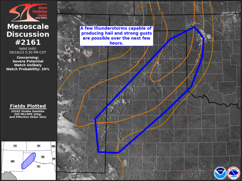
   Mesoscale Discussion 2161
   NWS Storm Prediction Center Norman OK
   0333 PM CDT Mon Sep 18 2023

   Areas affected...portions of southeast New Mexico into the Texas
   Panhandle and western Oklahoma

   Concerning...Severe potential...Watch unlikely

   Valid 182033Z - 182230Z

   Probability of Watch Issuance...20 percent

   SUMMARY...Isolated thunderstorm development is expected within the
   next 1-2 hours. Sporadic strong storms capable of producing near 1
   inch hail and strong gusts are possible into early evening.

   DISCUSSION...An increasing cumulus field has developed this
   afternoon from southeast NM into western OK in the vicinity of a
   surface trough. Some deepening of the cumulus with towering
   characteristics has been noted near western portions of the Texas
   South Plains. Isolated thunderstorms are expected to develop across
   the MCD area in the next couple of hours.

   Strong heating into the mid 80s to near 90 F and modest
   boundary-layer moisture is contributing to MLCAPE values near
   1000-1500 J/kg. Vertical shear will remain somewhat weak through the
   evening, with effective shear magnitudes around 15-25 kt noted in
   20z mesoanalysis and regional 88-D VWPs. Loosely organized
   cells/clusters may pose a risk for locally strong/damaging gusts,
   supported by steep low-level lapse rates and a deeply mixed
   boundary-layer. While weak vertical shear will limit longevity of
   organized convection, a couple of the stronger cells could produce
   marginally severe hail. Given the overall marginal environmental
   parameters, a severe thunderstorm watch is not currently expected.

   ..Leitman/Hart.. 09/18/2023

   ...Please see www.spc.noaa.gov for graphic product...

   ATTN...WFO...OUN...LUB...AMA...MAF...ABQ...

   LAT...LON   33690348 36230062 36609967 36249932 35669939 34729984
               33940084 32630259 32660333 33690348
|
|
Top/All Mesoscale Discussions/Forecast Products/Home
|
|


 @NWSSPC