|
| Mesoscale Discussion 217 |
|
< Previous MD Next MD >
|

|
   Mesoscale Discussion 0217
   NWS Storm Prediction Center Norman OK
   1034 PM CDT Tue Mar 12 2024

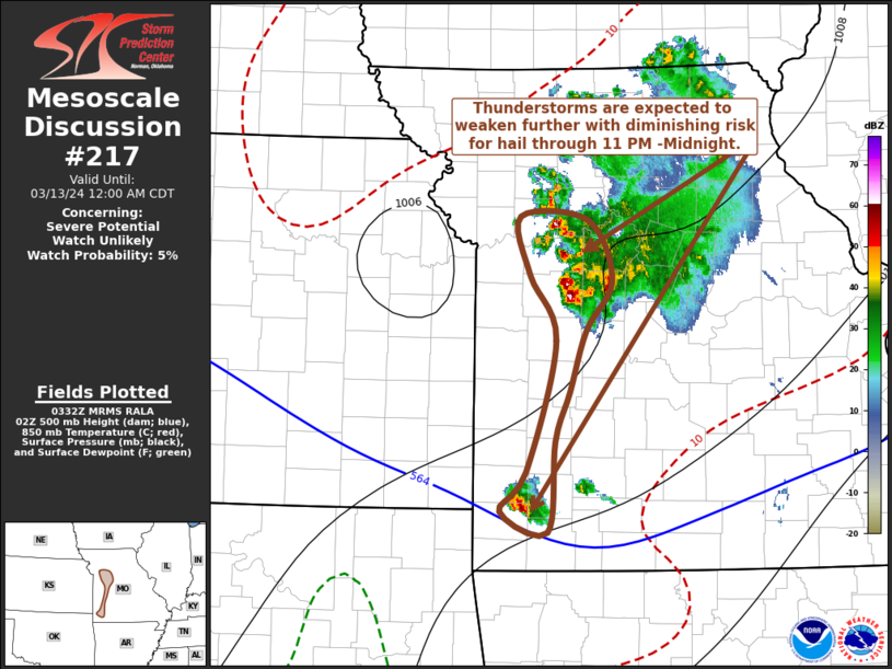
   Areas affected...parts of west central missouri and southwest
   Missouri

   Concerning...Severe potential...Watch unlikely

   Valid 130334Z - 130500Z

   Probability of Watch Issuance...5 percent

   SUMMARY...Some thunderstorm development posing a risk for severe
   hail remains possible, but appears likely to generally diminish
   through 11 PM-Midnight.

   DISCUSSION...Near the western periphery of the modestly
   strengthening and slowly veering southerly low-level jet, stronger
   ascent associated with low-level warm advection and inflow of better
   low-level moisture remain focused on the western flank of the
   upscale growing cluster of thunderstorms, east of the Greater Kansas
   City area.  Similar forcing and stronger convective layer shear may
   also be maintaining the more isolated cell now to the east-southeast
   of Joplin, with the strongest storms still accompanied by a
   continuing risk for severe hail based on latest MRMS data.  However,
   warming farther aloft is slowly underway across much of western
   Missouri, as the the mid-level short wave trough and associated cold
   core progress east-southeastward into the middle Mississippi Valley.
    It appears that this will contribute to substantive weakening of
   convection and diminishing hail potential through 04-06Z.

   ..Kerr/Thompson.. 03/13/2024

   ...Please see www.spc.noaa.gov for graphic product...

   ATTN...WFO...SGF...EAX...

   LAT...LON   38909404 39379413 39359344 38859318 38459345 37959363
               37559377 36819385 36979435 37309408 38369376 38909404
|
|
Top/All Mesoscale Discussions/Forecast Products/Home
|
|


