|
| Mesoscale Discussion 646 |
|
< Previous MD Next MD >
|
|
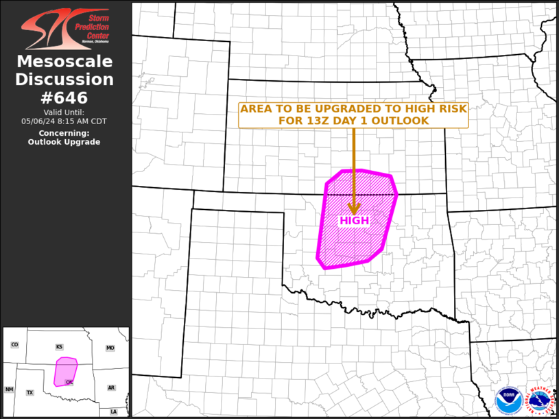
   Mesoscale Discussion 0646
   NWS Storm Prediction Center Norman OK
   0712 AM CDT Mon May 06 2024

   Areas affected...Central...West-central and North-central Oklahoma
   Into Far Southern Kansas

   Concerning...Outlook upgrade

   Valid 061212Z - 061315Z

   SUMMARY...An upgrade to High Risk will be done for the upcoming 13Z
   Day 1 Outlook. The following areas will be upgraded to High Risk.

   DISCUSSION...Central Oklahoma
   North-central Oklahoma
   West-central Oklahoma
   Far Southern Kansas

   Please refer to 13Z Day 1 Outlook for detailed reasoning.

   ..Broyles/Edwards.. 05/06/2024

   ...Please see www.spc.noaa.gov for graphic product...

   ATTN...WFO...TSA...ICT...OUN...DDC...

   LAT...LON   37489646 37659743 37629808 37289860 35319888 35039864
               35129798 35249725 35559679 36999628 37489646
|
|
Top/All Mesoscale Discussions/Forecast Products/Home
|
|


 @NWSSPC