|
| Mesoscale Discussion 700 |
|
< Previous MD Next MD >
|
|
Mesoscale Discussion 0700
NWS Storm Prediction Center Norman OK
1258 PM CDT Wed May 08 2024
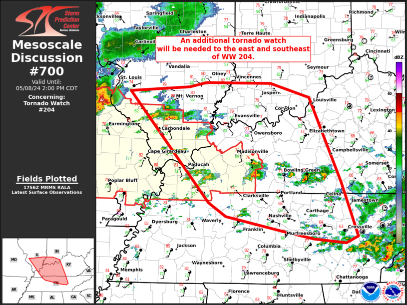
Areas affected...southern IL...southwest IN...western/central
KY...middle TN
Concerning...Tornado Watch 204...
Valid 081758Z - 081900Z
The severe weather threat for Tornado Watch 204 continues.
SUMMARY...An additional tornado watch will be needed soon to the
north and east of WW 204.
DISCUSSION...Supercells near the edge of WW 204 will spread east,
with additional development anticipated to the southeast through the
rest of the afternoon. Environment is recovering in the wake of an
earlier MCS that is now over the southern Appalachians. A mix of all
hazards is expected.
..Grams/Smith.. 05/08/2024
...Please see www.spc.noaa.gov for graphic product...
ATTN...WFO...MRX...LMK...OHX...IND...PAH...ILX...MEG...LSX...
LAT...LON 38458991 38558855 38638818 38618671 38368583 36828513
35848477 35718504 35808575 35948644 36208772 36468810
36468810 38458991
|
|
Top/All Mesoscale Discussions/Forecast Products/Home
|
|


 @NWSSPC