 Note:
The expiration time in the watch graphic is amended if the watch is
replaced, cancelled or extended.
Note:
Note:
The expiration time in the watch graphic is amended if the watch is
replaced, cancelled or extended.
Note: Click for
Watch Status Reports.
SEL7
URGENT - IMMEDIATE BROADCAST REQUESTED
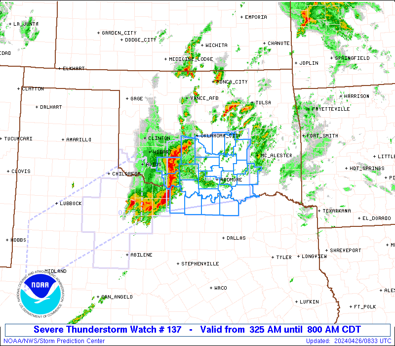
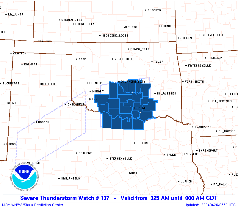
Severe Thunderstorm Watch Number 137
NWS Storm Prediction Center Norman OK
325 AM CDT Fri Apr 26 2024
The NWS Storm Prediction Center has issued a
* Severe Thunderstorm Watch for portions of
Southern Oklahoma
Extreme north Texas
* Effective this Friday morning from 325 AM until 800 AM CDT.
* Primary threats include...
Scattered damaging wind gusts to 70 mph possible
Scattered large hail events to 1.5 inches in diameter possible
A tornado or two possible
SUMMARY...A line of storms appears to be organizing near and north
of the Red River, and these storms will spread east-northeastward
through the early morning hours. Damaging winds of 60-70 mph will
be the main threat, along with occasional large hail of 1-1.5 inches
in diameter. A tornado or two will also be possible with
circulations embedded in the line.
The severe thunderstorm watch area is approximately along and 60
statute miles north and south of a line from 20 miles south
southwest of Fort Sill OK to 55 miles north northeast of Durant OK.
For a complete depiction of the watch see the associated watch
outline update (WOUS64 KWNS WOU7).
PRECAUTIONARY/PREPAREDNESS ACTIONS...
REMEMBER...A Severe Thunderstorm Watch means conditions are
favorable for severe thunderstorms in and close to the watch area.
Persons in these areas should be on the lookout for threatening
weather conditions and listen for later statements and possible
warnings. Severe thunderstorms can and occasionally do produce
tornadoes.
&&
OTHER WATCH INFORMATION...CONTINUE...WW 135...
AVIATION...A few severe thunderstorms with hail surface and aloft to
1.5 inches. Extreme turbulence and surface wind gusts to 60 knots. A
few cumulonimbi with maximum tops to 500. Mean storm motion vector
25040.
...Thompson

   SEL7

   URGENT - IMMEDIATE BROADCAST REQUESTED
   Severe Thunderstorm Watch Number 137
   NWS Storm Prediction Center Norman OK
   325 AM CDT Fri Apr 26 2024

   The NWS Storm Prediction Center has issued a

   * Severe Thunderstorm Watch for portions of
     Southern Oklahoma
     Extreme north Texas

   * Effective this Friday morning from 325 AM until 800 AM CDT.

   * Primary threats include...
     Scattered damaging wind gusts to 70 mph possible
     Scattered large hail events to 1.5 inches in diameter possible
     A tornado or two possible

   SUMMARY...A line of storms appears to be organizing near and north
   of the Red River, and these storms will spread east-northeastward
   through the early morning hours.  Damaging winds of 60-70 mph will
   be the main threat, along with occasional large hail of 1-1.5 inches
   in diameter.  A tornado or two will also be possible with
   circulations embedded in the line.

   The severe thunderstorm watch area is approximately along and 60
   statute miles north and south of a line from 20 miles south
   southwest of Fort Sill OK to 55 miles north northeast of Durant OK.
   For a complete depiction of the watch see the associated watch
   outline update (WOUS64 KWNS WOU7).

   PRECAUTIONARY/PREPAREDNESS ACTIONS...

   REMEMBER...A Severe Thunderstorm Watch means conditions are
   favorable for severe thunderstorms in and close to the watch area.
   Persons in these areas should be on the lookout for threatening
   weather conditions and listen for later statements and possible
   warnings. Severe thunderstorms can and occasionally do produce
   tornadoes.

   &&

   OTHER WATCH INFORMATION...CONTINUE...WW 135...

   AVIATION...A few severe thunderstorms with hail surface and aloft to
   1.5 inches. Extreme turbulence and surface wind gusts to 60 knots. A
   few cumulonimbi with maximum tops to 500. Mean storm motion vector
   25040.

   ...Thompson
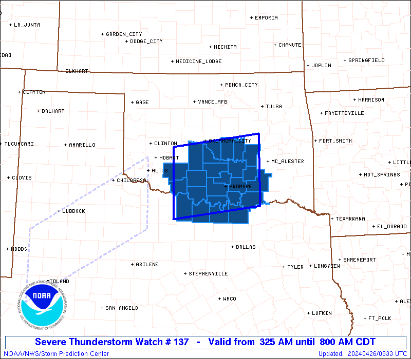
 Note:
The Aviation Watch (SAW) product is an approximation to the watch area.
The actual watch is depicted by the shaded areas.
Note:
The Aviation Watch (SAW) product is an approximation to the watch area.
The actual watch is depicted by the shaded areas.
   SAW7
   WW 137 SEVERE TSTM OK TX 260825Z - 261300Z
   AXIS..60 STATUTE MILES NORTH AND SOUTH OF LINE..
   20SSW FSI/FORT SILL OK/ - 55NNE DUA/DURANT OK/
   ..AVIATION COORDS.. 50NM N/S /24N SPS - 16SW MLC/
   HAIL SURFACE AND ALOFT..1.5 INCHES. WIND GUSTS..60 KNOTS.
   MAX TOPS TO 500. MEAN STORM MOTION VECTOR 25040.

   LAT...LON 35259853 35559603 33829603 33509853

   THIS IS AN APPROXIMATION TO THE WATCH AREA.  FOR A
   COMPLETE DEPICTION OF THE WATCH SEE WOUS64 KWNS
   FOR WOU7.
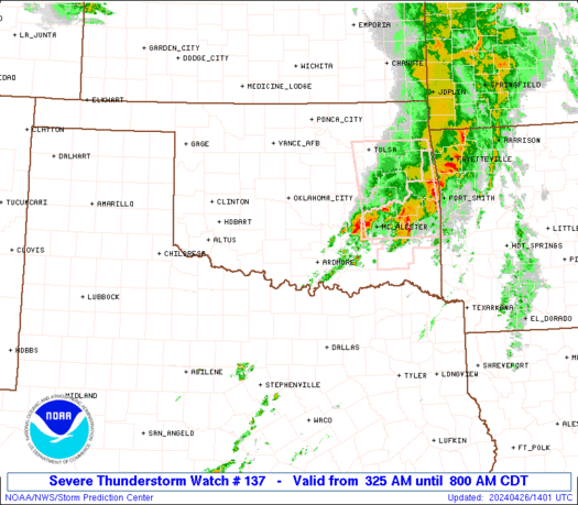
Watch 137 Status Report Messages:
STATUS REPORT #2 ON WW 137

VALID 261240Z - 261340Z

SEVERE WEATHER THREAT CONTINUES RIGHT OF A LINE FROM SPS TO 20
NNW ADM TO 40 W MLC TO 25 SE CQB.

..GUYER..04/26/24

ATTN...WFO...OUN...FWD...

&&

STATUS REPORT FOR WS 137

SEVERE WEATHER THREAT CONTINUES FOR THE FOLLOWING AREAS

OKC005-013-019-029-063-067-069-085-095-099-123-261340-

OK
.    OKLAHOMA COUNTIES INCLUDED ARE

ATOKA		     BRYAN		 CARTER
COAL		     HUGHES		 JEFFERSON
JOHNSTON	     LOVE		 MARSHALL
MURRAY		     PONTOTOC
$$


TXC077-097-181-337-261340-

TX
.    TEXAS COUNTIES INCLUDED ARE

CLAY		     COOKE		 GRAYSON
MONTAGUE
$$


THE WATCH STATUS MESSAGE IS FOR GUIDANCE PURPOSES ONLY.  PLEASE
REFER TO WATCH COUNTY NOTIFICATION STATEMENTS FOR OFFICIAL
INFORMATION ON COUNTIES...INDEPENDENT CITIES AND MARINE ZONES
CLEARED FROM SEVERE THUNDERSTORM AND TORNADO WATCHES.
$$

STATUS REPORT #1 ON WW 137

VALID 261035Z - 261140Z

SEVERE WEATHER THREAT CONTINUES RIGHT OF A LINE FROM 20 WSW SPS
TO 15 NW ADM TO 25 SSW CQB TO 10 WNW CQB.

FOR ADDITIONAL INFORMATION SEE MESOSCALE DISCUSSION 523

..DEAN..04/26/24

ATTN...WFO...OUN...FWD...

&&

STATUS REPORT FOR WS 137

SEVERE WEATHER THREAT CONTINUES FOR THE FOLLOWING AREAS

OKC005-013-019-029-049-063-067-069-085-095-099-123-125-133-
261140-

OK
.    OKLAHOMA COUNTIES INCLUDED ARE

ATOKA		     BRYAN		 CARTER
COAL		     GARVIN		 HUGHES
JEFFERSON	     JOHNSTON		 LOVE
MARSHALL	     MURRAY		 PONTOTOC
POTTAWATOMIE	     SEMINOLE
$$


TXC077-097-181-337-261140-

TX
.    TEXAS COUNTIES INCLUDED ARE

CLAY		     COOKE		 GRAYSON
MONTAGUE
$$


THE WATCH STATUS MESSAGE IS FOR GUIDANCE PURPOSES ONLY.  PLEASE
REFER TO WATCH COUNTY NOTIFICATION STATEMENTS FOR OFFICIAL
INFORMATION ON COUNTIES...INDEPENDENT CITIES AND MARINE ZONES
CLEARED FROM SEVERE THUNDERSTORM AND TORNADO WATCHES.
$$
Note:
Click for Complete Product Text.
Tornadoes
Probability of 2 or more tornadoes
|
Low (20%)
|
Probability of 1 or more strong (EF2-EF5) tornadoes
|
Low (5%)
|
Wind
Probability of 10 or more severe wind events
|
Mod (50%)
|
Probability of 1 or more wind events > 65 knots
|
Low (20%)
|
Hail
Probability of 10 or more severe hail events
|
Mod (40%)
|
Probability of 1 or more hailstones > 2 inches
|
Low (10%)
|
Combined Severe Hail/Wind
Probability of 6 or more combined severe hail/wind events
|
High (70%)
|
For each watch, probabilities for particular events inside the watch
(listed above in each table) are determined by the issuing forecaster.
The "Low" category contains probability values ranging from less than 2%
to 20% (EF2-EF5 tornadoes), less than 5% to 20% (all other probabilities),
"Moderate" from 30% to 60%, and "High" from 70% to greater than 95%.
High values are bolded and lighter in color to provide awareness of
an increased threat for a particular event.


 @NWSSPC