|
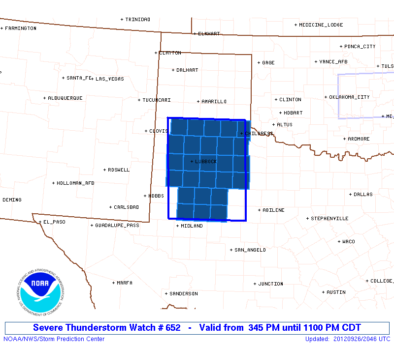
Initial List of Counties in SPC Severe Thunderstorm Watch 652 (WOU)
|
Back to Watch 652
|
 |
   WOUS64 KWNS 262043
   WOU2

   BULLETIN - IMMEDIATE BROADCAST REQUESTED
   SEVERE THUNDERSTORM WATCH OUTLINE UPDATE FOR WS 652
   NWS STORM PREDICTION CENTER NORMAN OK
   345 PM CDT WED SEP 26 2012

   SEVERE THUNDERSTORM WATCH 652 IS IN EFFECT UNTIL 1100 PM CDT
   FOR THE FOLLOWING LOCATIONS

   TXC033-045-069-075-101-107-115-125-153-169-189-191-219-227-263-
   269-279-303-305-317-335-345-415-433-437-445-270400-
   /O.NEW.KWNS.SV.A.0652.120926T2045Z-120927T0400Z/

   TX
   .    TEXAS COUNTIES INCLUDED ARE

   BORDEN               BRISCOE             CASTRO
   CHILDRESS            COTTLE              CROSBY
   DAWSON               DICKENS             FLOYD
   GARZA                HALE                HALL
   HOCKLEY              HOWARD              KENT
   KING                 LAMB                LUBBOCK
   LYNN                 MARTIN              MITCHELL
   MOTLEY               SCURRY              STONEWALL
   SWISHER              TERRY


   ATTN...WFO...MAF...LUB...
|
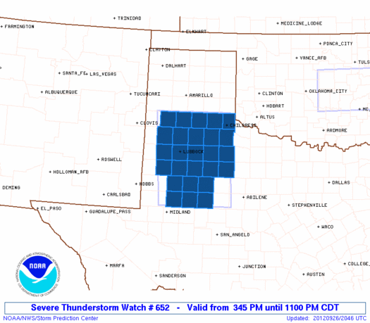
| Aviation Watch (SAW) for WW652 |
|---|
 |
| Note:
The Aviation Watch (SAW) product is an approximation to the watch area.
The actual watch is depicted by the shaded areas. |
   SAW2
   WW 652 SEVERE TSTM TX 262045Z - 270400Z
   AXIS..70 STATUTE MILES EAST AND WEST OF LINE..
   15ESE BGS/BIG SPRING TX/ - 45NNE PVW/PLAINVIEW TX/
   ..AVIATION COORDS.. 60NM E/W /47E MAF - 33SSE AMA/
   HAIL SURFACE AND ALOFT..2 INCHES. WIND GUSTS..60 KNOTS.
   MAX TOPS TO 500. MEAN STORM MOTION VECTOR 24025.

   LAT...LON 32130245 34770265 34770018 32130006

   THIS IS AN APPROXIMATION TO THE WATCH AREA.  FOR A
   COMPLETE DEPICTION OF THE WATCH SEE WOUS64 KWNS
   FOR WOU2.
|
|


 @NWSSPC