|
| Mesoscale Discussion 459 |
|
< Previous MD Next MD >
|
|
Mesoscale Discussion 0459
NWS Storm Prediction Center Norman OK
0750 AM CDT Sat May 19 2018
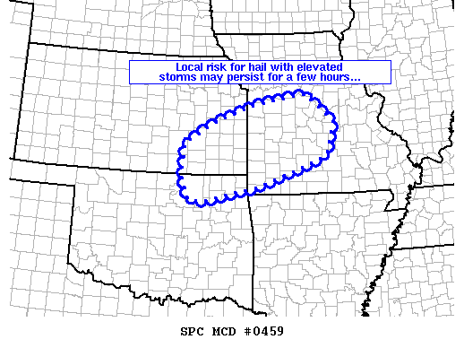
Areas affected...parts of northeast Oklahoma...southeast
Kansas...and eastward into central Missouri
Concerning...Severe potential...Watch unlikely
Valid 191250Z - 191445Z
Probability of Watch Issuance...20 percent
SUMMARY...Isolated hail exceeding severe levels may occur over the
next few hours with isolated stronger/elevated storms.
DISCUSSION...Latest radar loop shows regeneration of elevated
convection over the past hour, atop a remnant outflow from prior
convection. The storms are occurring near the nose of a veering of
the low-level jet, within an environment featuring steep mid-level
lapse rates -- and thus moderate elevated CAPE.
Shear through the cloud-bearing layer is not particularly strong,
with generally unidirectional southwest flow. As such, storms
should remain only weakly organized -- with perhaps occasional/weak
mid-level rotation. Further, as the low-level jet diminishes
through the morning, storms should eventually decrease in intensity
as well. In the mean time however, hail generally in the 1 to 1.5"
range may occur with the most vigorous storms.
..Goss/Guyer.. 05/19/2018
...Please see www.spc.noaa.gov for graphic product...
ATTN...WFO...LSX...SGF...EAX...TSA...TOP...ICT...
LAT...LON 38319185 37439211 36879371 36709425 36299605 36389647
36939670 37779663 38319570 38759439 39049274 38319185
|
|
Top/All Mesoscale Discussions/Forecast Products/Home
|
|


 @NWSSPC