|
| Mesoscale Discussion 769 |
|
< Previous MD Next MD >
|
|
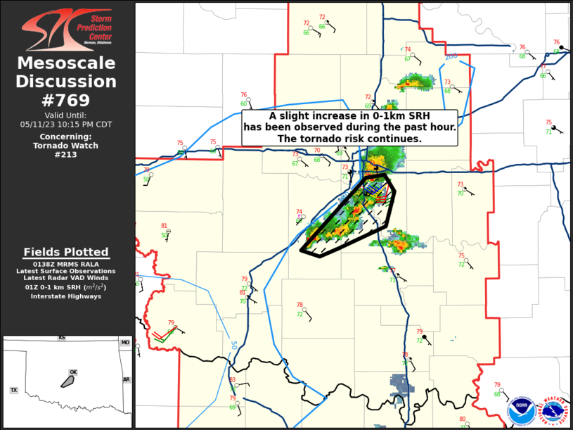
   Mesoscale Discussion 0769
   NWS Storm Prediction Center Norman OK
   0841 PM CDT Thu May 11 2023

   Areas affected...a small portion of central OK

   Concerning...Tornado Watch 213...

   Valid 120141Z - 120315Z

   The severe weather threat for Tornado Watch 213 continues.

   SUMMARY...A slight increase in 0-1km SRH has been observed during
   the past hour.  The tornado risk continues.

   DISCUSSION...A cluster of supercells continues to straddle the I-35
   and I-44 corridors south of OKC.  The 00 UTC Norman, OK raob showed
   a very unstable airmass (2900 J/kg MLCAPE) with around 40 kt
   effective shear---supporting supercells capable of tornadoes.  Very
   moist low level conditions (surface dewpoints around 70 deg F) with
   some slight increase in low-level SRH (200 m2/s2 0-1km SRH per
   observed storm motions) will continue to support supercell
   tornadogenesis for the next hour or two.

   ..Smith.. 05/12/2023

   ...Please see www.spc.noaa.gov for graphic product...

   ATTN...WFO...OUN...

   LAT...LON   34879798 35349746 35379731 35259723 35039730 34879770
               34829783 34879798
|
|
Top/All Mesoscale Discussions/Forecast Products/Home
|
|


 @NWSSPC